
Size of this preview: 800 × 375 pixels. Other resolutions: 320 × 150 pixels | 640 × 300 pixels | 1,024 × 480 pixels | 1,280 × 600 pixels | 2,185 × 1,024 pixels.
Original file (2,185 × 1,024 pixels, file size: 285 KB, MIME type: image/jpeg)
| This is a file from the Wikimedia Commons. Information from its description page there is shown below. Commons is a freely licensed media file repository. You can help. |


Summary
| Description |
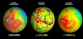
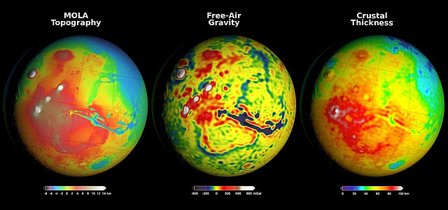
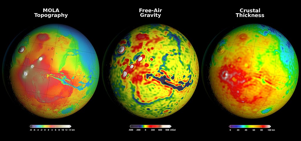
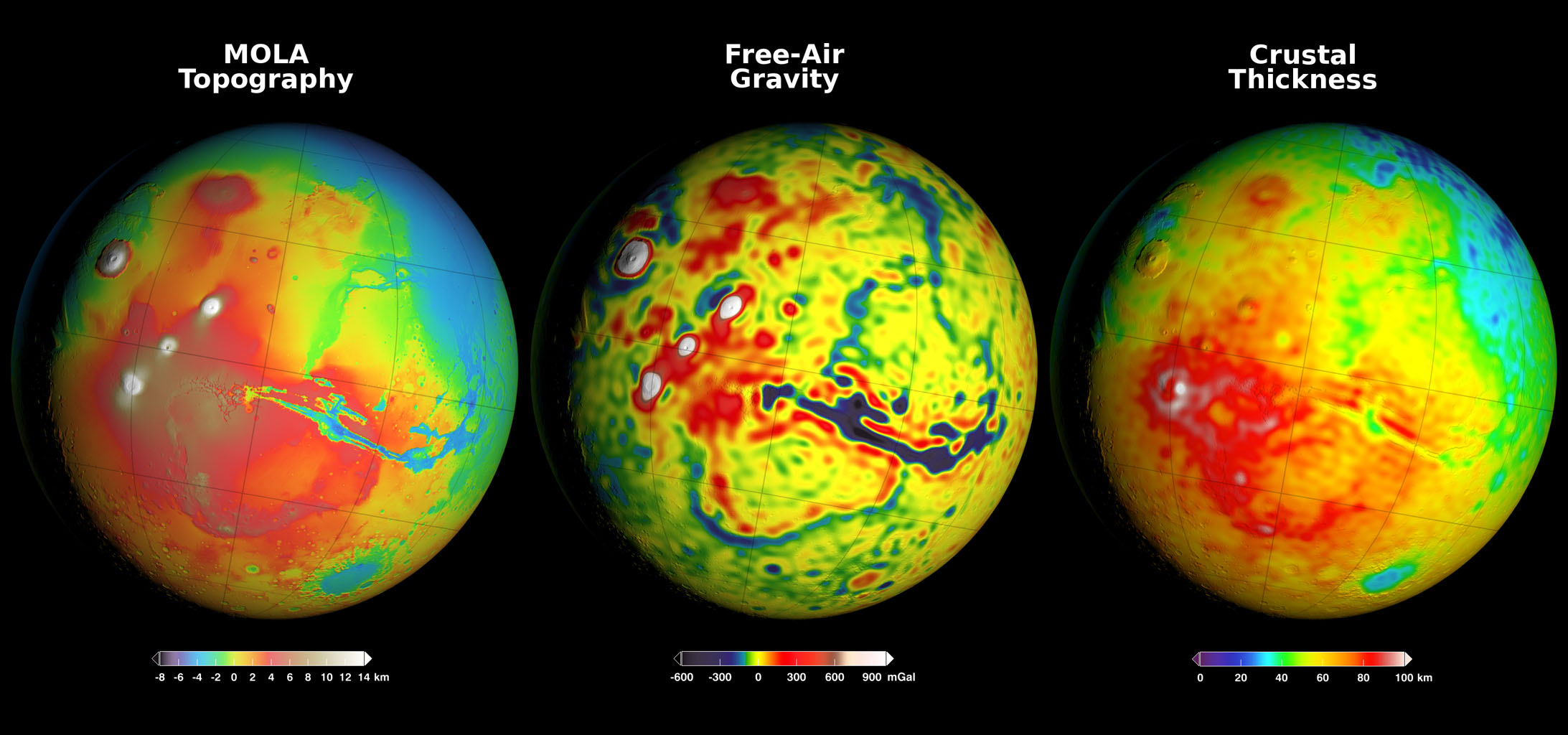
English: Newly detailed mapping of local variations in Mars' gravitational pull on orbiters (center), combined with topographical mapping of the planet's mountains and valleys (left) yields the best-yet mapping of Mars' crustal thickness (right). The data come from many years of using NASA's Deep Space Network to track positions and velocities of NASA's Mars Global Surveyor, Mars Odyssey and Mars Reconnaissance Orbiter.
These three views of global mapping are centered at 90 degrees west longitude, showing portions of the planet that include tall volcanoes on the left and the deep Valles Marineris canyon system just right of center. Additional views of these global maps are available at http://svs.gsfc.nasa.gov/goto?4436.
Русский: Карта толщины коры Марса (справа), составленная на основании последних точных данных об интенсивности гравитационного поля (в середине) и топографической карте высот (слева). Гравитационное поле измерялось в течение нескольких лет орбитальными аппаратами Mars Global Surveyor, Mars Odyssey и Mars Reconnaissance Orbiter, а их положения и скорости отслеживались Сетью дальней космической связи НАСА.
Показана часть поверхности Марса, включающая высокие вулканы слева и крупнейшую систему каньонов долины Маринер справа от центра - меридиана 90° западной долготы. Другие карты доступны на странице http://svs.gsfc.nasa.gov/goto?4436. |
| Date | |
| Source | https://www.jpl.nasa.gov/spaceimages/images/largesize/PIA20277_hires.jpg |
| Author | NASA/GSFC/Scientific Visualization Studio |
Licensing
| This file is in the public domain in the United States because it was solely created by NASA. NASA copyright policy states that "NASA material is not protected by copyright unless noted". (See Template:PD-USGov, NASA copyright policy page or JPL Image Use Policy.) | ||
 |
Warnings:
|
File history
Click on a date/time to view the file as it appeared at that time.
| Date/Time | Thumbnail | Dimensions | User | Comment | |
|---|---|---|---|---|---|
| current | 18:06, 5 September 2017 | | 2,185 × 1,024 (285 KB) | Skyd4ncer33 | User created page with UploadWizard |
File usage
The following page uses this file:
Global file usage
The following other wikis use this file:
- Usage on ca.wiki.x.io
- Usage on es.wiki.x.io
- Usage on pt.wiki.x.io
- Usage on ru.wiki.x.io