
Size of this preview: 800 × 585 pixels. Other resolutions: 320 × 234 pixels | 640 × 468 pixels | 1,024 × 749 pixels | 1,280 × 936 pixels | 1,480 × 1,082 pixels.
Original file (1,480 × 1,082 pixels, file size: 2.22 MB, MIME type: image/png)
| This is a file from the Wikimedia Commons. Information from its description page there is shown below. Commons is a freely licensed media file repository. You can help. |
Summary
{{Information
|description=
| Description |
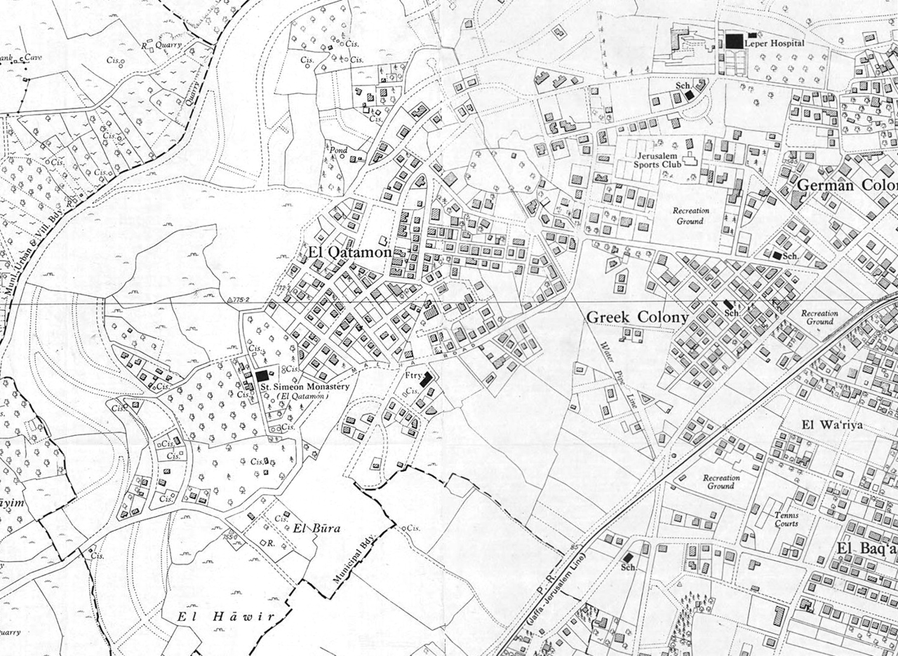
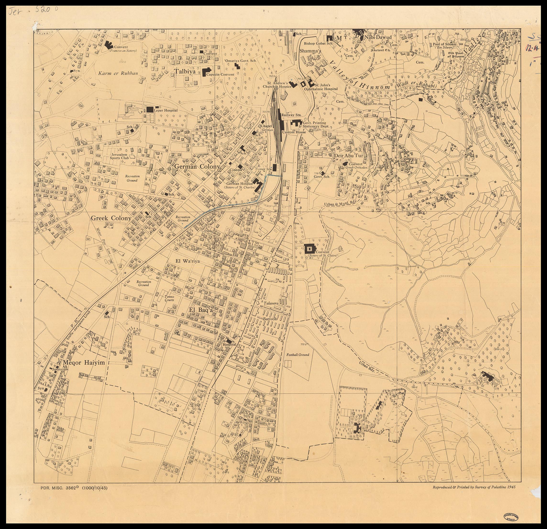
English: A detailed and accurate measurment map of Jerusalem, produced by the Survey of Palestine, 1945. Scale 1:5,000. Map was created as merger of this and this.
עברית: מפת מדידה מדויקת ומפורטת של ירושלים, בקנה מידה 1:5,000 שהוכנה ע"י מחלקת המדידות של ממשלת המנדט, 1945. |
|||
| Date | ||||
| Source | The Eran Laor Cartographic Collection, National Library of Israel | |||
| Author | The National Library of Israel, editted by Bolter21. |


Licensing
|
This work is in the public domain in its country of origin and other countries and areas where the copyright term is the author's life plus 70 years or fewer. | |
| This file has been identified as being free of known restrictions under copyright law, including all related and neighboring rights. | |
File history
Click on a date/time to view the file as it appeared at that time.
| Date/Time | Thumbnail | Dimensions | User | Comment | |
|---|---|---|---|---|---|
| current | 21:31, 18 February 2017 | | 1,480 × 1,082 (2.22 MB) | Bolter21 | User created page with UploadWizard |
File usage
The following page uses this file:
Global file usage
The following other wikis use this file:
- Usage on he.wiki.x.io