
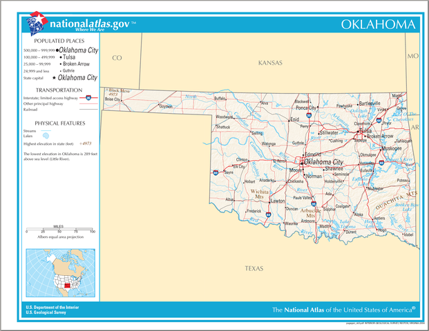
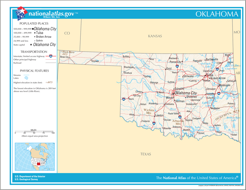
Size of this preview: 776 × 600 pixels. Other resolutions: 311 × 240 pixels | 621 × 480 pixels | 994 × 768 pixels | 1,280 × 989 pixels | 2,122 × 1,640 pixels.
Original file (2,122 × 1,640 pixels, file size: 1.42 MB, MIME type: image/png)
| This is a file from the Wikimedia Commons. Information from its description page there is shown below. Commons is a freely licensed media file repository. You can help. |
Summary
| Description |
English: Map of Oklahoma. |
| Date | |
| Source | National Atlas |
| Author |
Licensing
This map was obtained from an edition of the National Atlas of the United States. Like almost all works of the U.S. federal government, works from the National Atlas are in the public domain in the United States.
Online access: NationalAtlas.gov | 1970 print edition: Library of Congress, Perry-Castañeda Library
|
File history
Click on a date/time to view the file as it appeared at that time.
| Date/Time | Thumbnail | Dimensions | User | Comment | |
|---|---|---|---|---|---|
| current | 08:09, 15 August 2006 | | 2,122 × 1,640 (1.42 MB) | Huebi~commonswiki | {{Information| |Description=Map of Oklahoma |Source=[http://www.nationalatlas.gov National Atlas] }} Category:Maps of the United States Category:Maps of Oklahoma {{PD-USGov-Atlas}} |
File usage
The following 2 pages use this file:
Global file usage
The following other wikis use this file:
- Usage on de.wiki.x.io
- Usage on eo.wiki.x.io
- Usage on hu.wiki.x.io
- Usage on incubator.wikimedia.org
- Usage on it.wiki.x.io
- Usage on lt.wiki.x.io
- Usage on qu.wiki.x.io
- Usage on sw.wiki.x.io
- Usage on szl.wiki.x.io
- Usage on zea.wiki.x.io