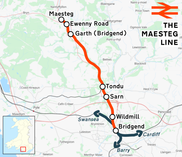
Size of this preview: 694 × 599 pixels. Other resolutions: 278 × 240 pixels | 556 × 480 pixels | 984 × 850 pixels.
Original file (984 × 850 pixels, file size: 580 KB, MIME type: image/png)
File history
Click on a date/time to view the file as it appeared at that time.
| Date/Time | Thumbnail | Dimensions | User | Comment | |
|---|---|---|---|---|---|
| current | 13:46, 12 April 2024 |  | 984 × 850 (580 KB) | Rcsprinter123 | == {{int:filedesc}} == {{OpenStreetMap |name = |location = |description = The en:Maesteg Line |top = |bottom = |left = |right = |date = 2024-04-12 |authors = |other_versions = }} =={{int:license-header}}== {{self|cc-by-3.0}} Category:Rail transport maps of Wales |
File usage
The following page uses this file:
Global file usage
The following other wikis use this file:
- Usage on www.wikidata.org
