
Size of this preview: 800 × 596 pixels. Other resolutions: 320 × 238 pixels | 640 × 477 pixels | 1,024 × 762 pixels | 1,280 × 953 pixels | 1,930 × 1,437 pixels.
Original file (1,930 × 1,437 pixels, file size: 5.14 MB, MIME type: image/png)
| This is a file from the Wikimedia Commons. Information from its description page there is shown below. Commons is a freely licensed media file repository. You can help. |
This work is an Ordnance Survey map over 50 years old, which is covered by Crown Copyright which in this case expires 50 years after publication. Ordnance Survey does however ask that they be credited and that the date of publication be given.
Any ancillary rights gained through the creation of the electronic version are granted as freely usable under any circumstances.
|
This work created by the United Kingdom Government is in the public domain.
This is because it is one of the following:
HMSO has declared that the expiry of Crown Copyrights applies worldwide (ref: HMSO Email Reply)
|
 |
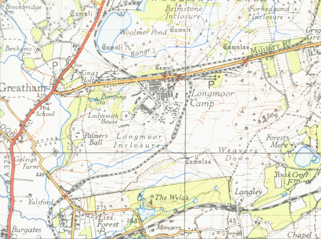
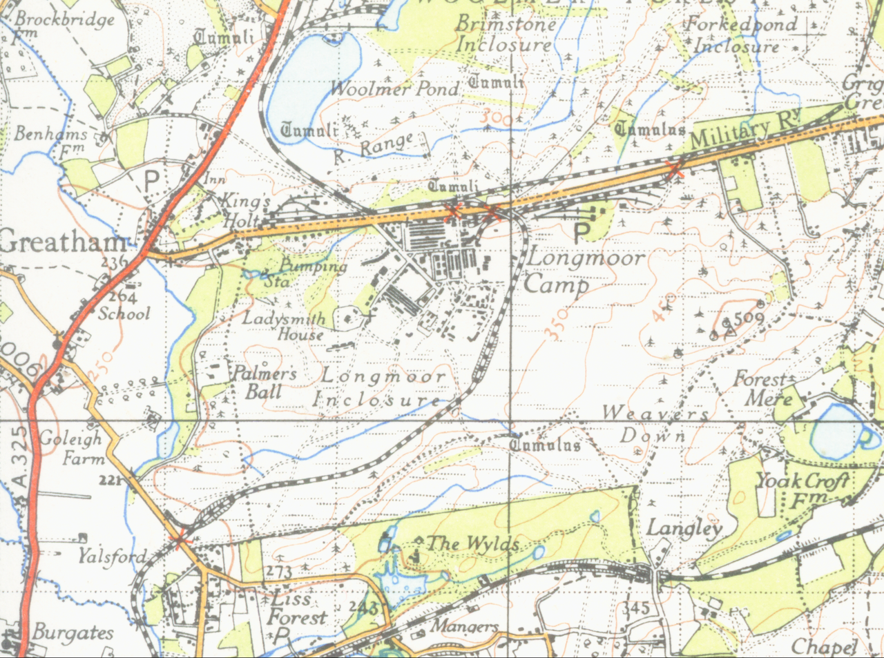
| Description | map of Grays 1 inch to the mile scale scanned at 600 DPI |
| Date | |
| Source | OS map London S.E sheet 171 1946 |
| Author | OS |
File history
Click on a date/time to view the file as it appeared at that time.
| Date/Time | Thumbnail | Dimensions | User | Comment | |
|---|---|---|---|---|---|
| current | 15:20, 22 November 2009 | | 1,930 × 1,437 (5.14 MB) | Geni | {{oldOS}} {{Information |Description=map of Grays 1 inch to the mile scale scanned at 600 DPI |Source=OS map London S.E sheet 171 1946 |Date=1946 |Author=OS |Permission=none needed |other_versions= }} Category:Longmoor Military Railway [[Category:Lo |
File usage
The following page uses this file: