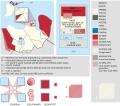
Size of this PNG preview of this SVG file: 568 × 600 pixels. Other resolutions: 227 × 240 pixels | 455 × 480 pixels | 727 × 768 pixels | 970 × 1,024 pixels | 1,939 × 2,048 pixels | 1,000 × 1,056 pixels.
Original file (SVG file, nominally 1,000 × 1,056 pixels, file size: 184 KB)
File history
Click on a date/time to view the file as it appeared at that time.
| Date/Time | Thumbnail | Dimensions | User | Comment | |
|---|---|---|---|---|---|
| current | 12:49, 16 November 2011 |  | 1,000 × 1,056 (184 KB) | TUBS |
File usage
The following 15 pages use this file:
- Campo Municipal de Aterrizaje Airport
- José Batlle y Ordóñez, Uruguay
- José Pedro Varela, Uruguay
- Lavalleja Department
- Mariscala
- Minas, Uruguay
- Pirarajá
- Salto del Penitente
- Sierra de las Ánimas
- Solís de Mataojo
- Villa Serrana
- Zapicán
- User:GerardM/Provinces of Uruguay
- Template:Lavalleja-geo-stub
- Template:Lavalleja Department
Global file usage
The following other wikis use this file:
- Usage on ar.wiki.x.io
- Usage on ast.wiki.x.io
- Usage on be-tarask.wiki.x.io
- Usage on be.wiki.x.io
- Usage on bg.wiki.x.io
- Usage on ca.wiki.x.io
- Usage on ceb.wiki.x.io
- Usage on da.wiki.x.io
- Usage on de.wiki.x.io
- Usage on eo.wiki.x.io
- Usage on es.wiki.x.io
- Usage on eu.wiki.x.io
- Usage on fi.wiki.x.io
- Usage on frr.wiki.x.io
- Usage on fr.wiki.x.io
View more global usage of this file.


