.jpg)
.jpg&action=edit&redlink=1)

Size of this preview: 800 × 533 pixels. Other resolutions: 320 × 213 pixels | 640 × 426 pixels | 1,024 × 682 pixels | 1,280 × 853 pixels | 2,560 × 1,705 pixels | 5,041 × 3,358 pixels.
Original file (5,041 × 3,358 pixels, file size: 6.02 MB, MIME type: image/jpeg)
| This is a file from the Wikimedia Commons. Information from its description page there is shown below. Commons is a freely licensed media file repository. You can help. |
.jpg)
Summary
| Description |
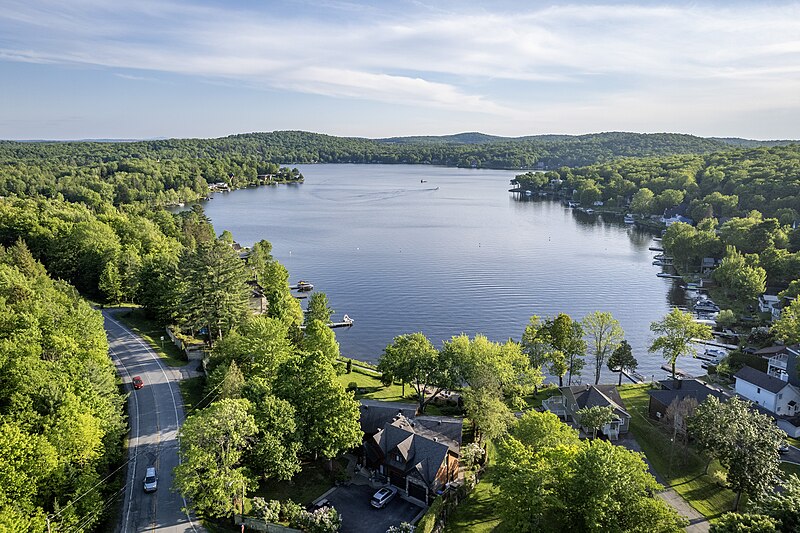
Français : Vue aérienne du lac Poulin à Lac-Poulin, Québec.
English: Aerial virw Lake Poulin in Lac-Poulin, Quebec. |
| Date | |
| Source | Own work |
| Author | Gabriel Picard |
| Camera location | | View this and other nearby images on: OpenStreetMap |
|---|
.jpg¶ms=046.105470_N_-070.812583_E_globe:Earth_type:camera__&language=en)
Licensing
I, the copyright holder of this work, hereby publish it under the following license:
This file is licensed under the Creative Commons Attribution-Share Alike 4.0 International license.
- You are free:
- to share – to copy, distribute and transmit the work
- to remix – to adapt the work
- Under the following conditions:
- attribution – You must give appropriate credit, provide a link to the license, and indicate if changes were made. You may do so in any reasonable manner, but not in any way that suggests the licensor endorses you or your use.
- share alike – If you remix, transform, or build upon the material, you must distribute your contributions under the same or compatible license as the original.
File history
Click on a date/time to view the file as it appeared at that time.
| Date/Time | Thumbnail | Dimensions | User | Comment | |
|---|---|---|---|---|---|
| current | 00:47, 7 June 2024 | | 5,041 × 3,358 (6.02 MB) | Gacard | Uploaded own work with UploadWizard |
File usage
The following page uses this file:
Global file usage
The following other wikis use this file:
- Usage on ar.wiki.x.io
- Usage on ceb.wiki.x.io
- Usage on eu.wiki.x.io
- Usage on fr.wiki.x.io
- Usage on fr.wikivoyage.org
- Usage on www.wikidata.org
.jpg)