
Size of this preview: 800 × 538 pixels. Other resolutions: 320 × 215 pixels | 640 × 431 pixels | 1,024 × 689 pixels | 1,360 × 915 pixels.
Original file (1,360 × 915 pixels, file size: 405 KB, MIME type: image/jpeg)
| This is a file from the Wikimedia Commons. Information from its description page there is shown below. Commons is a freely licensed media file repository. You can help. |
Licensing
|
This work is in the public domain in its country of origin and other countries and areas where the copyright term is the author's life plus 70 years or fewer. | |
| This file has been identified as being free of known restrictions under copyright law, including all related and neighboring rights. | |
| Description |
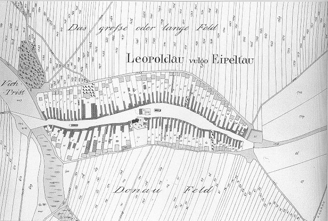
English: Map of Leopoldau (19th Century) (Wien, Austria) Deutsch: Leopoldau im 19. Jahrhundert (Wien) |
| Date | Unknown date |
| Source | Scanned by Geiserich77 from: Hinkel, Raimund; Landsmann, Kurt: Floridsdorf in alten Photographien. Wien 1996. |
| Author | Unknown author |
| Permission (Reusing this file) |
Public domain beacause of age |
File history
Click on a date/time to view the file as it appeared at that time.
| Date/Time | Thumbnail | Dimensions | User | Comment | |
|---|---|---|---|---|---|
| current | 08:46, 18 October 2005 | | 1,360 × 915 (405 KB) | Geiserich77 | == Licensing == {{PD-old}} {{Information| |Description = Map of Leopoldau (Wien) |Source = Scanned by Geiserich77 from: Hinkel, Raimund; Landsmann, Kurt: ''Floridsdorf in alten Photographien.'' Wien 1996. |Date = unknown |Author = unk |
File usage
The following page uses this file:
Global file usage
The following other wikis use this file:
- Usage on de.wiki.x.io