
Size of this PNG preview of this SVG file: 347 × 387 pixels. Other resolutions: 215 × 240 pixels | 430 × 480 pixels | 689 × 768 pixels | 918 × 1,024 pixels | 1,836 × 2,048 pixels.
Original file (SVG file, nominally 347 × 387 pixels, file size: 86 KB)
| This is a file from the Wikimedia Commons. Information from its description page there is shown below. Commons is a freely licensed media file repository. You can help. |
Summary
| Description |
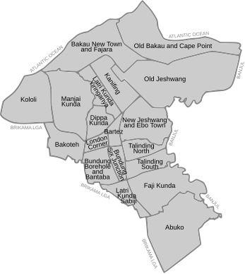
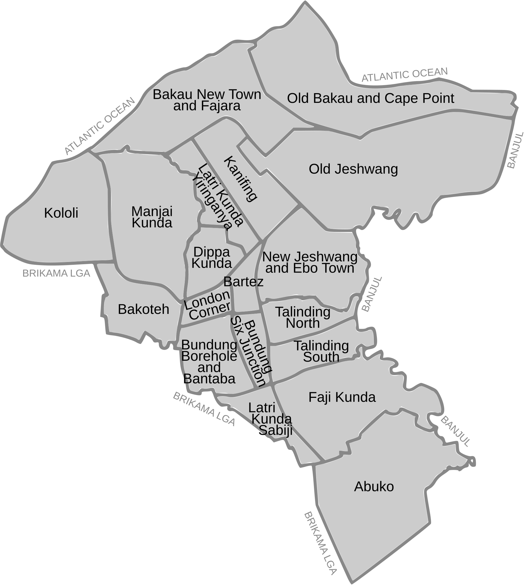
English: A map with names and outlines of the wards of Kanifing Municipal Council, the Gambia:
Abuko, Bakau New Town and Fajara, Bakoteh, Bundung Borehole and Bantaba, Bundung Six Junction, Dippa Kunda, Faji Kunda, Kanifing, Kololi, Latri Kunda Sabiji, Latri Kunda Yiringanya, Manjai Kunda, New Jeshwang and Ebo Town, Old Bakau and Cape Point, Old Jeshwang, Serekunda Bartez, Serekunda London Corner, Talinding North, Talinding South |
|||||||||
| Date | ||||||||||
| Source | openstreetmap.org | |||||||||
| Creator |
Own work OpenStreetMap contributors |
|||||||||
| Permission (Reusing this file) |
OpenStreetMap data is available under the Open Database License (details). Standard style map tiles are licensed as ODbL Produced Works.
|
|||||||||
| Geotemporal data | ||||||||||
| Bounding box |
|
|||||||||
| Georeferencing | If inappropriate please set warp_status = skip to hide. | |||||||||
Licensing
I, the copyright holder of this work, hereby publish it under the following license:
This file is licensed under the Creative Commons Attribution 4.0 International license.
- You are free:
- to share – to copy, distribute and transmit the work
- to remix – to adapt the work
- Under the following conditions:
- attribution – You must give appropriate credit, provide a link to the license, and indicate if changes were made. You may do so in any reasonable manner, but not in any way that suggests the licensor endorses you or your use.
File history
Click on a date/time to view the file as it appeared at that time.
| Date/Time | Thumbnail | Dimensions | User | Comment | |
|---|---|---|---|---|---|
| current | 16:20, 1 September 2024 | | 347 × 387 (86 KB) | Vigilantcosmicpenguin | Uploaded own work with UploadWizard |
File usage
The following pages on the English Wikipedia use this file (pages on other projects are not listed):