
Size of this preview: 600 × 600 pixels. Other resolutions: 240 × 240 pixels | 480 × 480 pixels | 768 × 768 pixels | 1,024 × 1,024 pixels | 1,750 × 1,750 pixels.
Original file (1,750 × 1,750 pixels, file size: 707 KB, MIME type: image/png)
| This is a file from the Wikimedia Commons. Information from its description page there is shown below. Commons is a freely licensed media file repository. You can help. |
Summary
| Description |
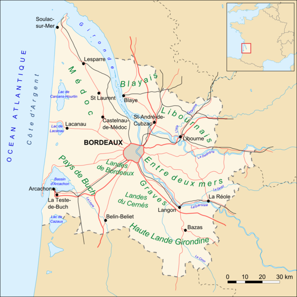
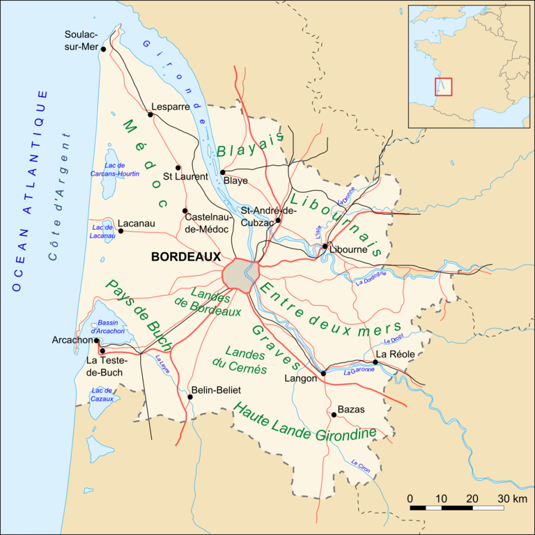
Carte du département de la Gironde (33), routes, villes et "Pays" Based upon Image:Gironde_map_blank.svg created by Sting |
| Date | 22 October 2006 (original upload date) |
| Source | No machine-readable source provided. Own work assumed (based on copyright claims). |
| Author | No machine-readable author provided. Mtu33260 assumed (based on copyright claims). |
Licensing
I, the copyright holder of this work, hereby publish it under the following license:
This file is licensed under the Creative Commons Attribution-Share Alike 2.5 Generic license.
- You are free:
- to share – to copy, distribute and transmit the work
- to remix – to adapt the work
- Under the following conditions:
- attribution – You must give appropriate credit, provide a link to the license, and indicate if changes were made. You may do so in any reasonable manner, but not in any way that suggests the licensor endorses you or your use.
- share alike – If you remix, transform, or build upon the material, you must distribute your contributions under the same or compatible license as the original.
File history
Click on a date/time to view the file as it appeared at that time.
| Date/Time | Thumbnail | Dimensions | User | Comment | |
|---|---|---|---|---|---|
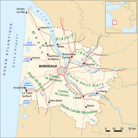
| current | 00:05, 11 November 2007 | | 1,750 × 1,750 (707 KB) | Larrousiney | == Summary == Carte du département de la Gironde (33), routes, villes et "Pays" Based upon Image:Gironde_map_blank.svg created by Sting == Licensing == {{self|cc-by-sa-2.5}} Category:Maps of Gironde [[Category:Transport in Aqui |
| 09:34, 22 October 2006 |  | 1,750 × 1,750 (697 KB) | Mtu33260 | Carte du département de la Gironde (33), routes, villes et "Pays" |
File usage
The following pages on the English Wikipedia use this file (pages on other projects are not listed):
Global file usage
The following other wikis use this file:
- Usage on af.wiki.x.io
- Usage on ast.wiki.x.io
- Usage on br.wiki.x.io
- Usage on de.wiki.x.io
- Usage on el.wiki.x.io
- Usage on eo.wiki.x.io
- Usage on es.wiki.x.io
- Usage on fr.wiki.x.io
- Gironde (département)
- Isle (rivière)
- Bazas
- La Teste-de-Buch
- Bassin d'Arcachon
- Langon (Gironde)
- Belin-Béliet
- Castelnau-de-Médoc
- Saint-Laurent-Médoc
- Entre-deux-Mers
- Lac d'Hourtin et de Carcans
- Lac de Lacanau
- Tourisme en Gironde
- Compagnie du chemin de fer de Bordeaux à La Teste
- Bordeaux
- Camp du Courneau
- Usage on gl.wiki.x.io
- Usage on id.wiki.x.io
- Usage on it.wiki.x.io
- Usage on ja.wiki.x.io
- Usage on jv.wiki.x.io
- Usage on lt.wiki.x.io
- Usage on nl.wiki.x.io
View more global usage of this file.