
Size of this PNG preview of this SVG file: 800 × 536 pixels. Other resolutions: 320 × 214 pixels | 640 × 429 pixels | 1,024 × 686 pixels | 1,280 × 858 pixels | 2,560 × 1,715 pixels | 1,000 × 670 pixels.
Original file (SVG file, nominally 1,000 × 670 pixels, file size: 24 KB)
| This is a file from the Wikimedia Commons. Information from its description page there is shown below. Commons is a freely licensed media file repository. You can help. |
Summary
| Description |
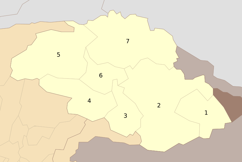
English: Districts of Gilgit-Baltistan as of Oct 2010 |
| Date | |
| Source | Own work |
| Author | Schajee |
| SVG development |
Licensing
| I, the copyright holder of this work, release this work into the public domain. This applies worldwide. In some countries this may not be legally possible; if so: I grant anyone the right to use this work for any purpose, without any conditions, unless such conditions are required by law. |
File history
Click on a date/time to view the file as it appeared at that time.
| Date/Time | Thumbnail | Dimensions | User | Comment | |
|---|---|---|---|---|---|
| current | 14:04, 31 July 2016 | | 1,000 × 670 (24 KB) | Furfur | enlarged the numbers, such that they can be read in the preview |
| 08:39, 11 October 2010 |  | 1,000 × 670 (27 KB) | Schajee | {{Information |Description={{en|1=Districts of Gilgit-Baltistan as of Oct 2010}} |Source={{own}} |Author=Schajee |Date= |Permission= |other_versions= }} Category:Maps of Pakistan |
File usage
The following 13 pages use this file:
- Azad Kashmir
- Baltistan Division
- City Districts of Pakistan
- Diamer Division
- Districts of Pakistan
- Federally Administered Tribal Areas
- Gilgit Division
- Pakistan
- Sindh
- Sujawal District
- User:Kazmi/Template:Neighbourhoods of Gilgit
- Template:Administrative units of Gilgit-Baltistan
- Template:List of districts of Pakistan
Global file usage
The following other wikis use this file:
- Usage on bn.wiki.x.io
- Usage on de.wiki.x.io
- Usage on fa.wiki.x.io
- Usage on fr.wiki.x.io
- Usage on hi.wiki.x.io
- Usage on ms.wiki.x.io
- Usage on ps.wiki.x.io
- Usage on pt.wiki.x.io
- Usage on ru.wiki.x.io
- Usage on simple.wiki.x.io
- Usage on ur.wiki.x.io