Size of this preview: 800 × 598 pixels. Other resolutions: 320 × 239 pixels | 640 × 478 pixels | 1,024 × 765 pixels | 1,280 × 956 pixels | 2,740 × 2,047 pixels.
Original file (2,740 × 2,047 pixels, file size: 891 KB, MIME type: image/jpeg)
| This is a file from the Wikimedia Commons. Information from its description page there is shown below. Commons is a freely licensed media file repository. You can help. |
Summary
| Description |
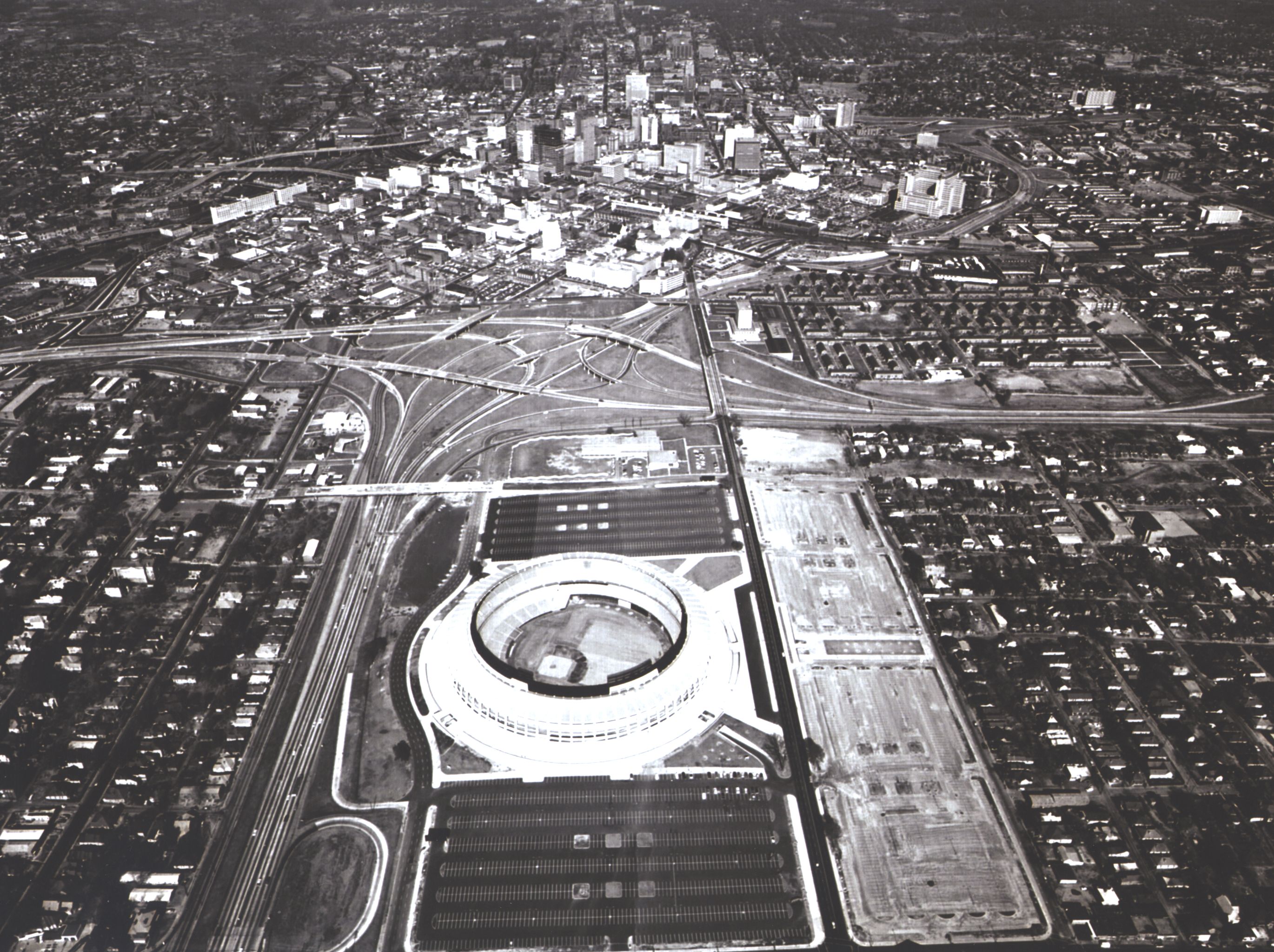
English: An aerial view of the interchange in Atlanta between Interstate Routes 20 (Right - Left) and 75 (Bottom - Top), Atlanta's new major league stadium dominates the foreground and the ever changing skyline makes a striking backdrop. |
| Date | |
| Source | https://highways.dot.gov/highway-history/general-highway-history/gallery/interstate-photo-gallery-all-high-resolution-images |
| Author | Federal Highway Adminstration |
| Object location | | View this and other nearby images on: OpenStreetMap |
|---|
Licensing
| This image is a work of a United States Department of Transportation employee, taken or made as part of that person's official duties. As a work of the U.S. federal government, the image is in the public domain.
|
File history
Click on a date/time to view the file as it appeared at that time.
| Date/Time | Thumbnail | Dimensions | User | Comment | |
|---|---|---|---|---|---|
| current | 17:25, 23 July 2024 | | 2,740 × 2,047 (891 KB) | TheImaCow | Cropped 11 % vertically, 11 % areawise using CropTool with lossless mode. |
| 01:45, 22 July 2024 |  | 2,740 × 2,288 (964 KB) | TheImaCow | Uploaded a work by Federal Highway Adminstration from https://highways.dot.gov/highway-history/general-highway-history/gallery/interstate-photo-gallery-all-high-resolution-images with UploadWizard |
File usage
The following pages on the English Wikipedia use this file (pages on other projects are not listed):