Size of this preview: 800 × 422 pixels. Other resolutions: 320 × 169 pixels | 640 × 338 pixels | 914 × 482 pixels.
Original file (914 × 482 pixels, file size: 106 KB, MIME type: image/jpeg)
File history
Click on a date/time to view the file as it appeared at that time.
| Date/Time | Thumbnail | Dimensions | User | Comment | |
|---|---|---|---|---|---|
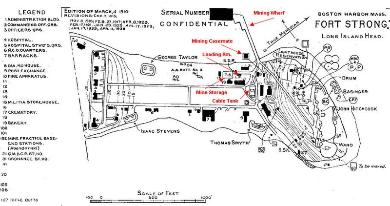
| current | 17:55, 4 July 2010 |  | 914 × 482 (106 KB) | Pgrig | This map, by the U.S. Army Engineers, is updated to show details as of 1938. It names the various gun batteries of the fort, all of which (minus their guns) still exist today (in 2010). The center portion of the fort, between the two roadways, was the pa |
File usage
The following 4 pages use this file:
