Size of this preview: 458 × 600 pixels. Other resolutions: 183 × 240 pixels | 366 × 480 pixels | 586 × 768 pixels | 782 × 1,024 pixels | 2,000 × 2,620 pixels.
Original file (2,000 × 2,620 pixels, file size: 1.79 MB, MIME type: image/jpeg)
| This is a file from the Wikimedia Commons. Information from its description page there is shown below. Commons is a freely licensed media file repository. You can help. |
Summary
| Description |
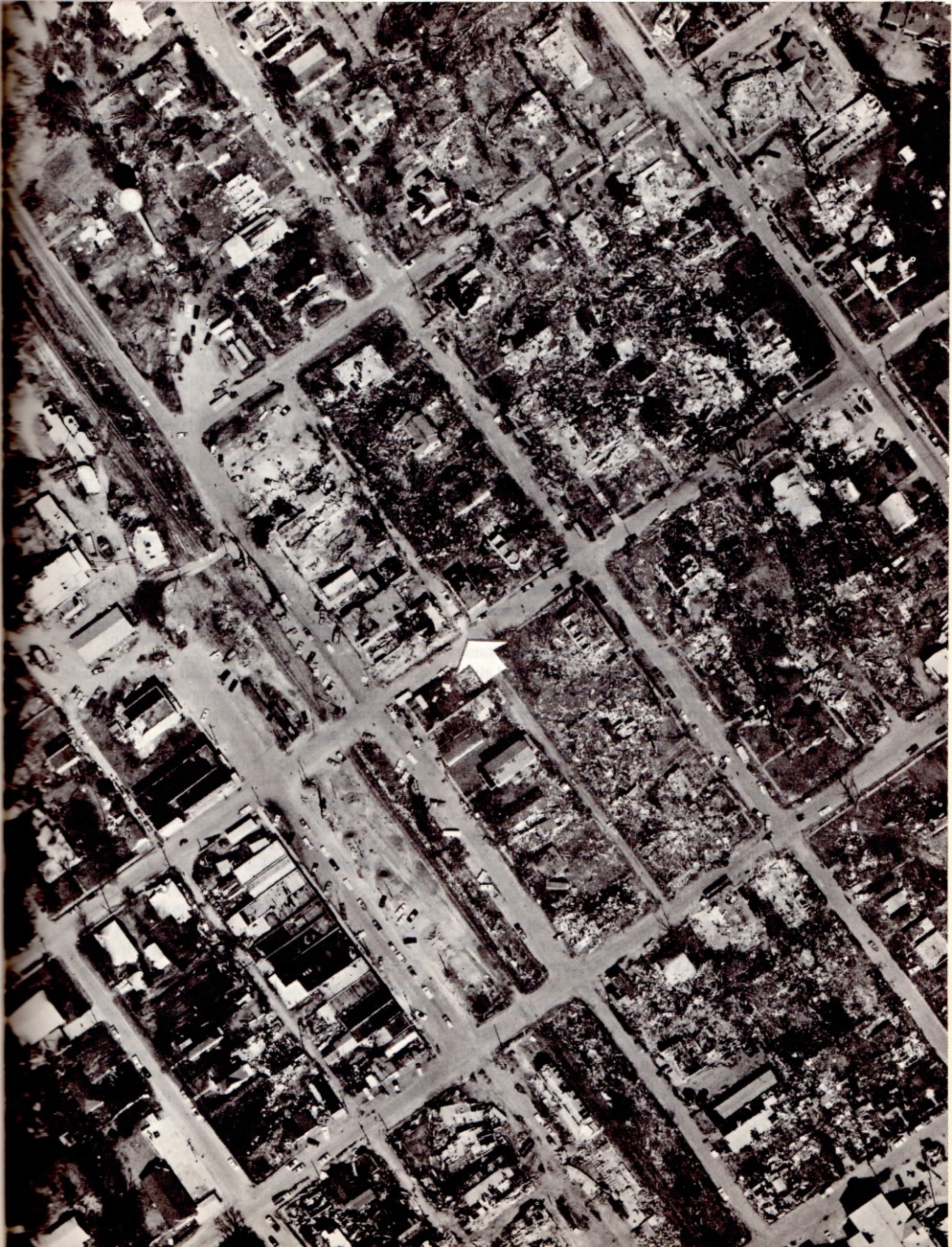
English: Aerial view of downtown Inverness, Sunflower County, Mississippi, after the F5 tornado of February 21, 1971. The tornado developed in Louisiana and produced F4 damage in Mississippi. |
| Date | |
| Source | Source |
| Author | NASA Earth Resources Laboratory |
Licensing
| This file is in the public domain in the United States because it was solely created by NASA. NASA copyright policy states that "NASA material is not protected by copyright unless noted". (See Template:PD-USGov, NASA copyright policy page or JPL Image Use Policy.) | ||
 |
Warnings:
|
File history
Click on a date/time to view the file as it appeared at that time.
| Date/Time | Thumbnail | Dimensions | User | Comment | |
|---|---|---|---|---|---|
| current | 13:39, 4 February 2023 | | 2,000 × 2,620 (1.79 MB) | CapeVerdeWave | Uploaded a work by National Weather Service from {{PD-NWS}} with UploadWizard |
File usage
The following pages on the English Wikipedia use this file (pages on other projects are not listed):