Size of this preview: 717 × 600 pixels. Other resolutions: 287 × 240 pixels | 574 × 480 pixels | 789 × 660 pixels.
Original file (789 × 660 pixels, file size: 120 KB, MIME type: image/jpeg)
| This is a file from the Wikimedia Commons. Information from its description page there is shown below. Commons is a freely licensed media file repository. You can help. |
Summary
| Description |
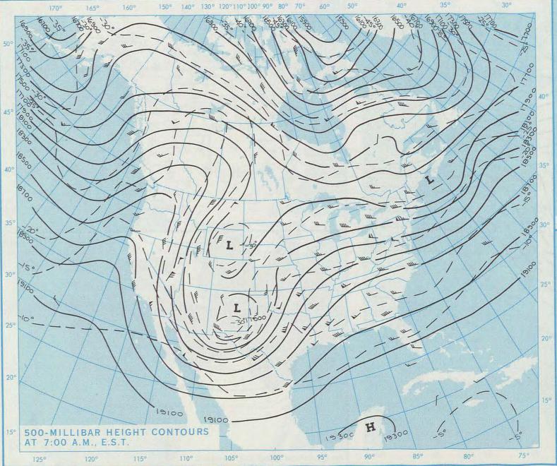
English: Upper-air analysis highlighting conditions over the contiguous United States at 12:00 UTC on February 21, 1971 |
| Date | |
| Source | Source |
| Author | National Weather Service |
Licensing
This image is in the public domain because it contains materials that originally came from the U.S. National Oceanic and Atmospheric Administration, taken or made as part of an employee's official duties.
|
File history
Click on a date/time to view the file as it appeared at that time.
| Date/Time | Thumbnail | Dimensions | User | Comment | |
|---|---|---|---|---|---|
| current | 13:39, 4 February 2023 | | 789 × 660 (120 KB) | CapeVerdeWave | Uploaded a work by National Weather Service from {{PD-NWS}} with UploadWizard |
File usage
The following pages on the English Wikipedia use this file (pages on other projects are not listed):