Size of this preview: 774 × 600 pixels. Other resolutions: 310 × 240 pixels | 619 × 480 pixels | 991 × 768 pixels | 1,280 × 992 pixels | 2,000 × 1,550 pixels.
Original file (2,000 × 1,550 pixels, file size: 503 KB, MIME type: image/jpeg)
File history
Click on a date/time to view the file as it appeared at that time.
| Date/Time | Thumbnail | Dimensions | User | Comment | |
|---|---|---|---|---|---|
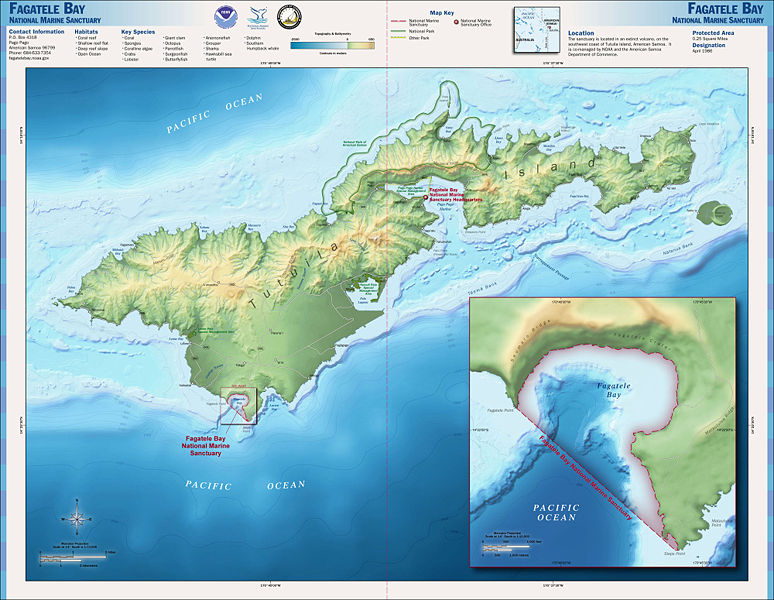
| current | 23:26, 8 July 2008 |  | 2,000 × 1,550 (503 KB) | Werewombat | == Summary == {{Information |Description=Map of the en:Fagatele Bay National Marine Sanctuary in en:American Samoa. |Source=http://www.sanctuaries.noaa.gov/pgallery/atlasmaps/ |Date=Downloaded 2008-07-08 |Author=[[:en:National Oceanic and Atmo |
File usage
The following 2 pages use this file:
Global file usage
The following other wikis use this file:
- Usage on ceb.wiki.x.io
- Usage on fr.wiki.x.io
- Usage on it.wiki.x.io
- Usage on lt.wiki.x.io
- Usage on ml.wiki.x.io
- Usage on sv.wiki.x.io
- Usage on vi.wiki.x.io
- Usage on www.wikidata.org
