.jpg)
.jpg&action=edit&redlink=1)
Size of this preview: 800 × 600 pixels. Other resolutions: 320 × 240 pixels | 640 × 480 pixels | 1,024 × 768 pixels | 1,280 × 960 pixels | 2,560 × 1,920 pixels | 3,264 × 2,448 pixels.
Original file (3,264 × 2,448 pixels, file size: 4.45 MB, MIME type: image/jpeg)
| This is a file from the Wikimedia Commons. Information from its description page there is shown below. Commons is a freely licensed media file repository. You can help. |
.jpg)
Summary
| Description |
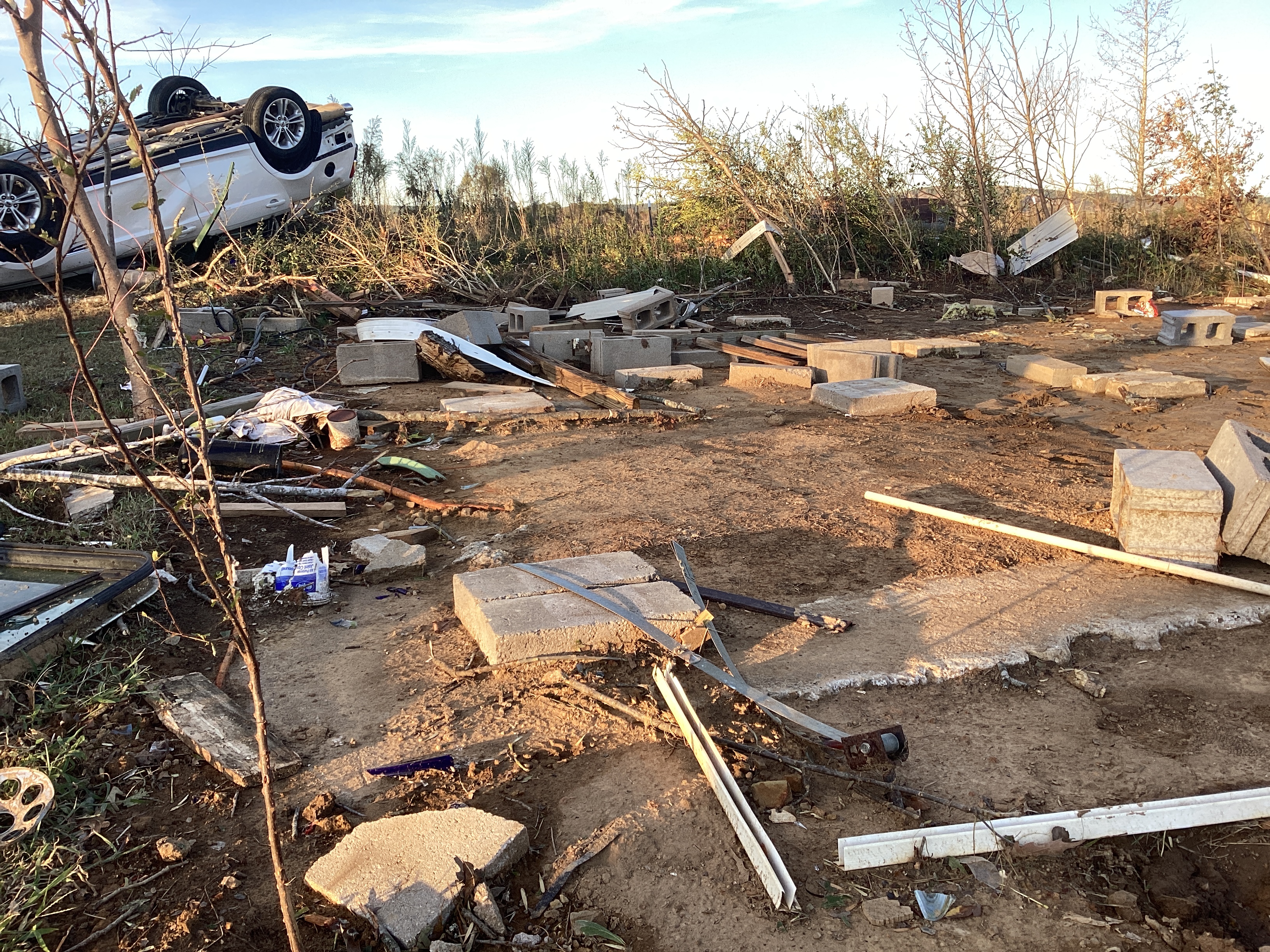
English: A mobile home that was destroyed and vehicle that was rolled by an EF2 tornado east of Pickens, Oklahoma. One person was killed at this location.
"Double wide mobile was tied down with straps, which were snapped or footings pulled out of the ground, vaulted to the NW one fatality. Male aged in his 70s is what we were told by family. Vehicle also rolled at this location" |
| Date | |
| Source | https://services.dat.noaa.gov/arcgis/rest/services/nws_damageassessmenttoolkit/DamageViewer/FeatureServer/0/3236698/attachments/1970852 |
| Author | National Weather Service Shreveport LA |
| Camera location | | View this and other nearby images on: OpenStreetMap |
|---|
.jpg¶ms=034.395889_N_-094.983458_E_globe:Earth_type:camera_heading:289.00&language=en)
Licensing
This work is in the public domain in the United States because it is a work prepared by an officer or employee of the United States Government as part of that person’s official duties under the terms of Title 17, Chapter 1, Section 105 of the US Code.
Note: This only applies to original works of the Federal Government and not to the work of any individual U.S. state, territory, commonwealth, county, municipality, or any other subdivision. This template also does not apply to postage stamp designs published by the United States Postal Service since 1978. (See § 313.6(C)(1) of Compendium of U.S. Copyright Office Practices). It also does not apply to certain US coins; see The US Mint Terms of Use.
|
 | |
| This file has been identified as being free of known restrictions under copyright law, including all related and neighboring rights. | ||
File history
Click on a date/time to view the file as it appeared at that time.
| Date/Time | Thumbnail | Dimensions | User | Comment | |
|---|---|---|---|---|---|
| current | 07:14, 27 June 2024 | | 3,264 × 2,448 (4.45 MB) | ChessEric | Uploaded a work by National Weather Service Shreveport LA from https://services.dat.noaa.gov/arcgis/rest/services/nws_damageassessmenttoolkit/DamageViewer/FeatureServer/0/3236698/attachments/1970852 with UploadWizard |
File usage
The following pages on the English Wikipedia use this file (pages on other projects are not listed):
.jpg)