_(en).svg)
_(en).svg&action=edit&redlink=1)

Size of this PNG preview of this SVG file: 463 × 599 pixels. Other resolutions: 185 × 240 pixels | 371 × 480 pixels | 593 × 768 pixels | 791 × 1,024 pixels | 1,582 × 2,048 pixels | 765 × 990 pixels.
Original file (SVG file, nominally 765 × 990 pixels, file size: 19 KB)
| This is a file from the Wikimedia Commons. Information from its description page there is shown below. Commons is a freely licensed media file repository. You can help. |
_(en).svg)
Summary
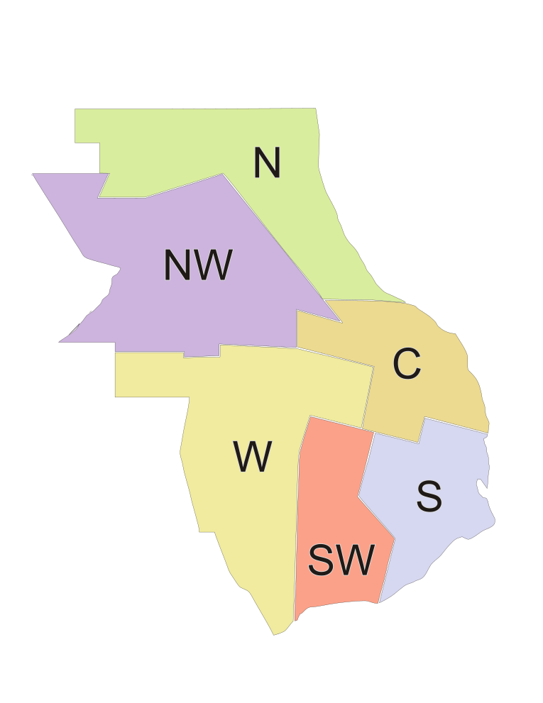
| Description | Districts of the municipality of Rosario, Argentina. Contour map, color-coded, noted with English initials for the district names: North, NorthWest, Center, West, SouthWest, South. |
| Date | |
| Source | Made it myself based on publicly available diagram at http://www.rosario.gov.ar |
| Author | Pablo D. Flores |
| Permission (Reusing this file) |
Public domain (use it for any purpose whatsoever) |
| Other versions | Image:Districts_of_Rosario_(blank).svg |
.svg)
Licensing
| I, the copyright holder of this work, release this work into the public domain. This applies worldwide. In some countries this may not be legally possible; if so: I grant anyone the right to use this work for any purpose, without any conditions, unless such conditions are required by law. |
File history
Click on a date/time to view the file as it appeared at that time.
| Date/Time | Thumbnail | Dimensions | User | Comment | |
|---|---|---|---|---|---|
| current | 00:05, 14 June 2006 | | 765 × 990 (19 KB) | Pablo-flores | {{Information |Description=Districts of the municipality of Rosario, Argentina. Contour map, color-coded, noted with English initials for the district names: North, NorthWest, Center, West, SouthWest, South. |Source=Made it myself based on publicl |
File usage
The following pages on the English Wikipedia use this file (pages on other projects are not listed):
_(en).svg)