Size of this preview: 711 × 600 pixels. Other resolutions: 285 × 240 pixels | 569 × 480 pixels.
Original file (800 × 675 pixels, file size: 155 KB, MIME type: image/jpeg)
File history
Click on a date/time to view the file as it appeared at that time.
| Date/Time | Thumbnail | Dimensions | User | Comment | |
|---|---|---|---|---|---|
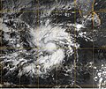
| current | 09:04, 12 October 2006 |  | 800 × 675 (155 KB) | NSLE-Chacor | Higher-res image from NRL ([http://www.nrlmry.navy.mil/tc-bin/tc_display.cgi?BASIN=IO&STORM_NAME=05A.AGNI&ACTION=Latest_Photos&ACTIVES=None&MOSAIC_SCALE=20&PHOT=yes&ATCF_BASIN=io&CGI=TC&AGE=Prev&ARCHIVE=all&NAV=tc&YR=04&ATCF_YR=2004&YEAR=2004&ATCF_FILE=/d |
| 03:00, 16 December 2005 |  | 495 × 413 (63 KB) | Hurricanehink | From the JTWC Cyclone Agni report at https://metoc.npmoc.navy.mil/jtwc/atcr/2004atcr/, this MET-5 visible satellite image shows Agni as a developing tropical storm just north of the equator. |
File usage
The following 2 pages use this file:
Global file usage
The following other wikis use this file:
- Usage on bs.wiki.x.io
- Usage on pt.wiki.x.io
- Usage on zh.wiki.x.io
