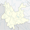
Size of this PNG preview of this SVG file: 596 × 599 pixels. Other resolutions: 239 × 240 pixels | 477 × 480 pixels | 764 × 768 pixels | 1,019 × 1,024 pixels | 2,037 × 2,048 pixels | 1,318 × 1,325 pixels.
Original file (SVG file, nominally 1,318 × 1,325 pixels, file size: 330 KB)
File history
Click on a date/time to view the file as it appeared at that time.
| Date/Time | Thumbnail | Dimensions | User | Comment | |
|---|---|---|---|---|---|
| current | 18:16, 15 March 2010 |  | 1,318 × 1,325 (330 KB) | NordNordWest | =={{int:filedesc}}== {{Information |Description= {{de|Positionskarte von Yunnan, Volksrepublik China}} Quadratische Plattkarte, N-S-Streckung 110 %. Geographische Begrenzung der Karte: * N: 29.5° N * S: 21.0° |
File usage
The following 6 pages use this file:
Global file usage
The following other wikis use this file:
- Usage on ar.wiki.x.io
- Usage on ast.wiki.x.io
- Usage on ba.wiki.x.io
- Usage on bg.wiki.x.io
- Usage on bn.wiki.x.io
- Usage on ceb.wiki.x.io
- Usage on cs.wiki.x.io
- Usage on eo.wiki.x.io
- Usage on es.wiki.x.io
- Lijiang
- Ciudad de Shangri-La
- Lago Erhai
- Chengjiang
- Yuxi
- Lago Fuxian
- Pu'er
- Qujing
- Prefectura autónoma bai de Dali
- Tengchong
- Wikiproyecto:Ilustración/Taller de Cartografía/Realizaciones/Asia
- Karst de Shilin
- Plantilla:Mapa de localización de Yunnan
- Aeropuerto Internacional de Kunming-Changshui
- Estanque del dragón negro
- Montes Gaoligong
- Puente Duge
- Zhanyi
- Montañas nevadas Mainri
- Montaña Nevada Dragón de Jade
- Usage on fa.wiki.x.io
View more global usage of this file.


