Size of this preview: 677 × 600 pixels. Other resolutions: 271 × 240 pixels | 542 × 480 pixels | 867 × 768 pixels | 1,156 × 1,024 pixels | 2,312 × 2,048 pixels | 3,234 × 2,865 pixels.
Original file (3,234 × 2,865 pixels, file size: 2.38 MB, MIME type: image/jpeg)
| This is a file from the Wikimedia Commons. Information from its description page there is shown below. Commons is a freely licensed media file repository. You can help. |
| Description |
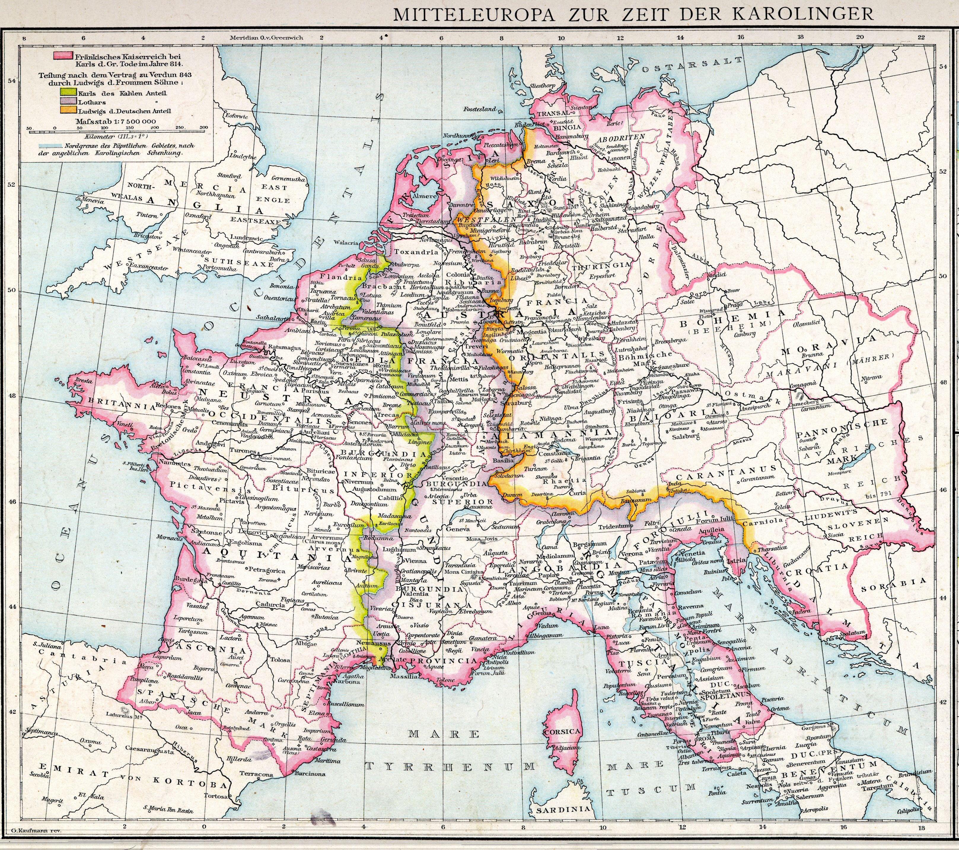
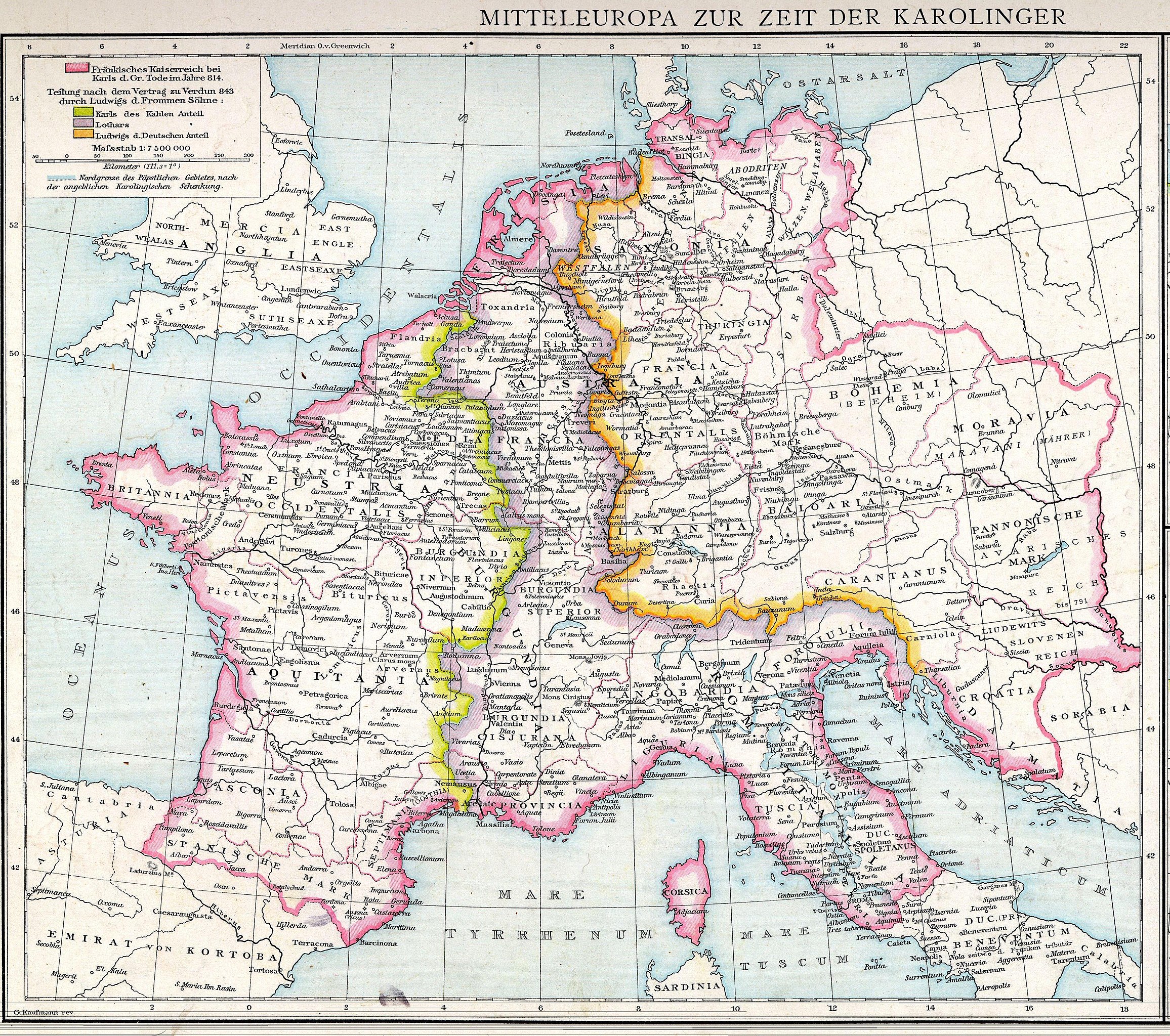
Deutsch: Mitteleuropa zur Zeit der Karolinger English: Central Europe in Carolingian times |
||||
| Date | |||||
| Source | Allgemeiner Historischer Handatlas | ||||
| Author | Johann Gustav Droysen | ||||
| Permission (Reusing this file) |
|
||||
| Other versions |
|
||||


File history
Click on a date/time to view the file as it appeared at that time.
| Date/Time | Thumbnail | Dimensions | User | Comment | |
|---|---|---|---|---|---|
| current | 12:47, 23 October 2017 | | 3,234 × 2,865 (2.38 MB) | FDRMRZUSA | High resolution; same license. |
| 01:33, 29 August 2011 |  | 1,565 × 1,343 (1.03 MB) | ZH2010 | {{Information |Description={{de|Mitteleuropa zur Zeit der Karolinger}}{{en|Central Europe in Carolingian times}} |Source=Allgemeiner Historischer Handatlas |Date=1886 |Author=Johann Gustav Droysen |Permission={{PD-old}} |other_versions=<gallery>File:Mitte |
File usage
The following pages on the English Wikipedia use this file (pages on other projects are not listed):
Global file usage
The following other wikis use this file:
- Usage on azb.wiki.x.io
- Usage on cs.wiki.x.io
- Usage on de.wiki.x.io
- Usage on el.wiki.x.io
- Usage on en.wikibooks.org
- Usage on et.wiki.x.io
- Usage on hu.wiki.x.io
- Usage on it.wiki.x.io
- Usage on lij.wiki.x.io
- Usage on mk.wiki.x.io
- Usage on sl.wiki.x.io
- Usage on uk.wiki.x.io