Original file (2,000 × 2,000 pixels, file size: 188 KB, MIME type: image/png)
| This is a file from the Wikimedia Commons. Information from its description page there is shown below. Commons is a freely licensed media file repository. You can help. |
Contents
Summary
| DescriptionCapeMayCanal.png |
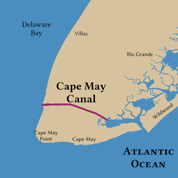
English: The path of the Cape May Canal |
||
| Date | |||
| Source | Own work | ||
| Creator | |||
| Credit line | © Tom Fish, geo.fish // Creative Commons BY-SA 4.0 | ||
| Permission (Reusing this file) |
|
||
| Georeferencing | Georeference the map in Wikimaps Warper If inappropriate please set warp_status = skip to hide. | ||
| PNG development InfoField | This map was created with ArcGIS Pro. |
Licensing
Data
| Public domainPublic domainfalsefalse |
| This file is in the public domain in the United States because it was solely created by the National Weather Service (NWS), including its name from 1870–1970, the United States Weather Bureau (USWB).
This includes the sub-branches of the National Weather Service:
As a file created by an employee of the NWS (formerly USWB) in the course of their official duties, whether hosted
this work is in the public domain in the United States because it is a work prepared by an officer or employee of the United States Government as part of that person’s official duties under the terms of Title 17, Chapter 1, Section 105 of the US Code. |
 | |
 |
Warnings: (Click here to view)
|
Final Map
- You are free:
- to share – to copy, distribute and transmit the work
- to remix – to adapt the work
- Under the following conditions:
- attribution – You must give appropriate credit, provide a link to the license, and indicate if changes were made. You may do so in any reasonable manner, but not in any way that suggests the licensor endorses you or your use.
- share alike – If you remix, transform, or build upon the material, you must distribute your contributions under the same or compatible license as the original.
Captions
Items portrayed in this file
depicts
image/png
26912a34bc6a642b099d4a19ecc41e654afcfb75
192,220 byte
2,000 pixel
2,000 pixel
File history
Click on a date/time to view the file as it appeared at that time.
| Date/Time | Thumbnail | Dimensions | User | Comment | |
|---|---|---|---|---|---|
| current | 17:41, 20 November 2021 |  | 2,000 × 2,000 (188 KB) | Guerillero | == {{int:filedesc}} == {{User:Guerillero/Template |Description= {{en|The path of the Cape May Canal}} |Date= 2021-11-20 }} == {{int:license-header}} == ===Data=== {{PD-NWS}} ===Final Map=== {{self|cc-by-sa-4.0}} Category:Intracoastal Waterway |
File usage
The following page uses this file:
Metadata
This file contains additional information, probably added from the digital camera or scanner used to create or digitize it.
If the file has been modified from its original state, some details may not fully reflect the modified file.
| Horizontal resolution | 196.85 dpc |
|---|---|
| Vertical resolution | 196.85 dpc |