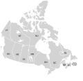
Size of this PNG preview of this SVG file: 619 × 600 pixels. Other resolutions: 248 × 240 pixels | 496 × 480 pixels | 793 × 768 pixels | 1,057 × 1,024 pixels | 2,114 × 2,048 pixels | 1,304 × 1,263 pixels.
Original file (SVG file, nominally 1,304 × 1,263 pixels, file size: 123 KB)
File history
Click on a date/time to view the file as it appeared at that time.
| Date/Time | Thumbnail | Dimensions | User | Comment | |
|---|---|---|---|---|---|
| current | 19:07, 7 January 2009 |  | 1,304 × 1,263 (123 KB) | Lokal Profil | Fixed NS (Nova Scotia) / NB (New Brunswick) issue |
| 21:20, 9 August 2007 |  | 1,304 × 1,263 (123 KB) | Rfc1394 | {{Information |Description={{en|SVG map of Canada labelled with province names}} Non-contiguous parts of a states/provinces are "grouped" together with the main area of the state/provinces, so any state/provinces can be coloured in completion with one cli |
File usage
The following 2 pages use this file:
Global file usage
The following other wikis use this file:
- Usage on ca.wiki.x.io
- Usage on eo.wiki.x.io
- Usage on es.wiki.x.io
- Usage on ja.wiki.x.io
- Usage on lt.wiki.x.io
- Usage on mk.wiki.x.io
- Usage on no.wiki.x.io
- Usage on sv.wiki.x.io
- Usage on tr.wiki.x.io
- Usage on zh-min-nan.wiki.x.io
- Usage on zh.wiki.x.io