
Size of this preview: 594 × 600 pixels. Other resolutions: 238 × 240 pixels | 475 × 480 pixels | 760 × 768 pixels | 1,014 × 1,024 pixels | 1,400 × 1,414 pixels.
Original file (1,400 × 1,414 pixels, file size: 1.41 MB, MIME type: image/jpeg)
| This is a file from the Wikimedia Commons. Information from its description page there is shown below. Commons is a freely licensed media file repository. You can help. |
Summary
| Description |
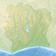
English: Relief location map of Côte_d'Ivoire.
|
| Date | |
| Source | Own work |
| Author | Uwe Dedering |
Licensing
I, the copyright holder of this work, hereby publish it under the following licenses:
This file is licensed under the Creative Commons Attribution-Share Alike 3.0 Unported license.
- You are free:
- to share – to copy, distribute and transmit the work
- to remix – to adapt the work
- Under the following conditions:
- attribution – You must give appropriate credit, provide a link to the license, and indicate if changes were made. You may do so in any reasonable manner, but not in any way that suggests the licensor endorses you or your use.
- share alike – If you remix, transform, or build upon the material, you must distribute your contributions under the same or compatible license as the original.

|
Permission is granted to copy, distribute and/or modify this document under the terms of the GNU Free Documentation License, Version 1.2 or any later version published by the Free Software Foundation; with no Invariant Sections, no Front-Cover Texts, and no Back-Cover Texts. A copy of the license is included in the section entitled GNU Free Documentation License. |
You may select the license of your choice.
File history
Click on a date/time to view the file as it appeared at that time.
| Date/Time | Thumbnail | Dimensions | User | Comment | |
|---|---|---|---|---|---|
| current | 12:26, 9 December 2010 | | 1,400 × 1,414 (1.41 MB) | Uwe Dedering | initial upload |
File usage
The following pages on the English Wikipedia use this file (pages on other projects are not listed):
- Aby Lagoon
- Assagny National Park
- Banco National Park
- Buyo Dam
- Comoé National Park
- Comoé National Park Research Station
- Ivory Coast Open
- Kossou Dam
- Lake Buyo
- Lake Kossou
- List of fossiliferous stratigraphic units in Ivory Coast
- Marahoué National Park
- Monogaga Classified Forest
- Mont-Korhogo
- Mont Péko National Park
- Mont Sângbé National Park
- Mount Richard-Molard
- N'zo Partial Faunal Reserve
- Taï National Park
- Îles Ehotilé National Park
- User:ETF89/sandbox
- Module:Location map/data/Cote d'Ivoire
- Module:Location map/data/Côte d'Ivoire
- Module:Location map/data/Ivory Coast
- Module:Location map/data/Ivory Coast/doc
Global file usage
The following other wikis use this file:
- Usage on als.wiki.x.io
- Usage on ar.wiki.x.io
- Usage on ast.wiki.x.io
- Usage on az.wiki.x.io
- Usage on ba.wiki.x.io
- Usage on be.wiki.x.io
- Usage on bg.wiki.x.io
- Usage on bn.wiki.x.io
- Usage on bs.wiki.x.io
- Usage on ca.wiki.x.io
- Usage on ceb.wiki.x.io
- Usage on ce.wiki.x.io
- Usage on ckb.wiki.x.io
- Usage on cs.wiki.x.io
- Usage on da.wiki.x.io
- Usage on de.wiki.x.io
- Usage on de.wikivoyage.org
View more global usage of this file.