
Size of this preview: 405 × 600 pixels. Other resolutions: 162 × 240 pixels | 324 × 480 pixels | 518 × 768 pixels | 1,200 × 1,777 pixels.
Original file (1,200 × 1,777 pixels, file size: 640 KB, MIME type: image/jpeg)
| This is a file from the Wikimedia Commons. Information from its description page there is shown below. Commons is a freely licensed media file repository. You can help. |
File history
Click on a date/time to view the file as it appeared at that time.
| Date/Time | Thumbnail | Dimensions | User | Comment | |
|---|---|---|---|---|---|
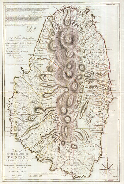
| current | 01:47, 10 December 2011 | | 1,200 × 1,777 (640 KB) | Magicpiano | {{Information |Description=A 1776 map of the Caribbean isle of w:Saint Vincent (island). The southern portion of the island was under British control, and the northern portion was under the control of the Black Caribs. |Source=http://www.pennymead.c |
File usage
The following 3 pages use this file:
Global file usage
The following other wikis use this file:
- Usage on bn.wiki.x.io
- Usage on fi.wiki.x.io
- Usage on fr.wiki.x.io
- Usage on it.wiki.x.io
- Usage on ja.wiki.x.io