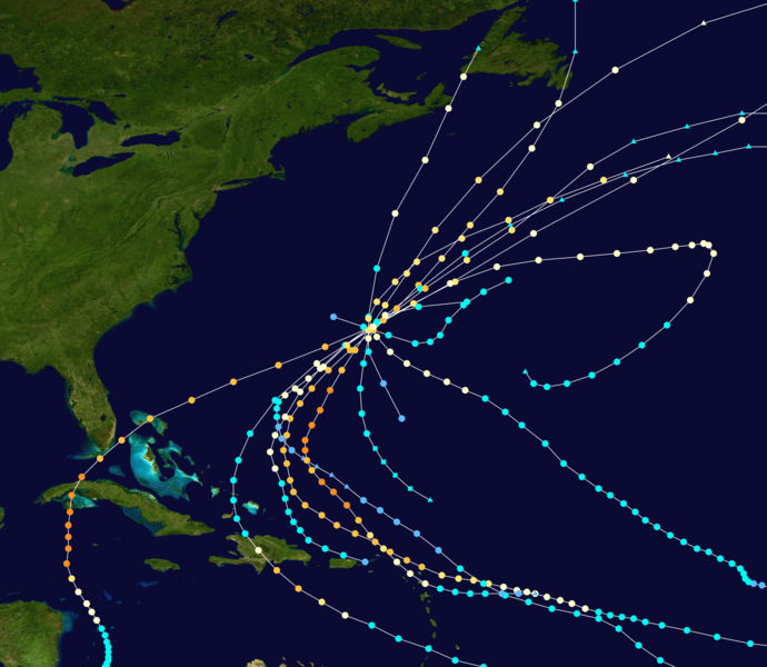
Size of this preview: 690 × 600 pixels. Other resolutions: 276 × 240 pixels | 552 × 480 pixels | 883 × 768 pixels | 1,178 × 1,024 pixels | 2,355 × 2,048 pixels | 4,000 × 3,478 pixels.
Original file (4,000 × 3,478 pixels, file size: 6.38 MB, MIME type: image/png)
File history
Click on a date/time to view the file as it appeared at that time.
| Date/Time | Thumbnail | Dimensions | User | Comment | |
|---|---|---|---|---|---|
| current | 02:09, 17 September 2020 |  | 4,000 × 3,478 (6.38 MB) | Cyclonebiskit | add Paulette |
| 07:43, 6 March 2020 |  | 4,000 × 3,478 (6.29 MB) | Cyclonebiskit | Arlene 63 and Brenda 64 HURDAT updates | |
| 20:01, 11 December 2015 |  | 4,000 × 3,478 (6.29 MB) | Cyclonebiskit | == {{int:filedesc}} == {{Information |Description={{en|Track map of all landfalling tropical cyclones in Bermuda since 1851. The points show the location of the storm at 6-hour intervals. The colour represents the storm's [... |
File usage
The following page uses this file:
Global file usage
The following other wikis use this file:
- Usage on fr.wiki.x.io