
Size of this preview: 800 × 528 pixels. Other resolutions: 320 × 211 pixels | 640 × 423 pixels | 1,024 × 676 pixels | 1,280 × 845 pixels | 2,584 × 1,706 pixels.
Original file (2,584 × 1,706 pixels, file size: 1.12 MB, MIME type: image/png)
| This is a file from the Wikimedia Commons. Information from its description page there is shown below. Commons is a freely licensed media file repository. You can help. |
Summary
| Description |
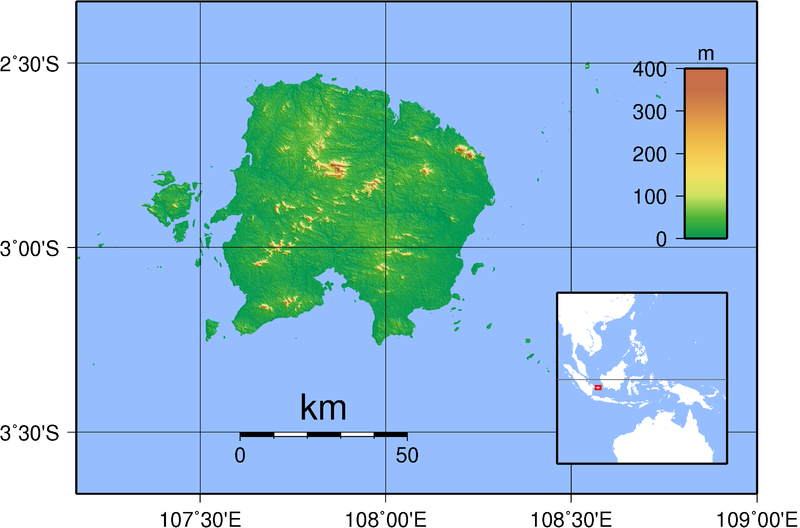
English: Topographic map of Belitung |
| Date | |
| Source | Own work. Created with GMT from SRTM data. |
| Author | Sadalmelik |
| Other versions | Derivative works of this file: Belitung shipwreck location.jpg |
Licensing
I, the copyright holder of this work, hereby publish it under the following licenses:

|
Permission is granted to copy, distribute and/or modify this document under the terms of the GNU Free Documentation License, Version 1.2 or any later version published by the Free Software Foundation; with no Invariant Sections, no Front-Cover Texts, and no Back-Cover Texts. A copy of the license is included in the section entitled GNU Free Documentation License. |
This file is licensed under the Creative Commons Attribution-Share Alike 3.0 Unported, 2.5 Generic, 2.0 Generic and 1.0 Generic license.
- You are free:
- to share – to copy, distribute and transmit the work
- to remix – to adapt the work
- Under the following conditions:
- attribution – You must give appropriate credit, provide a link to the license, and indicate if changes were made. You may do so in any reasonable manner, but not in any way that suggests the licensor endorses you or your use.
- share alike – If you remix, transform, or build upon the material, you must distribute your contributions under the same or compatible license as the original.
You may select the license of your choice.
File history
Click on a date/time to view the file as it appeared at that time.
| Date/Time | Thumbnail | Dimensions | User | Comment | |
|---|---|---|---|---|---|
| current | 19:37, 1 September 2007 | | 2,584 × 1,706 (1.12 MB) | Sadalmelik | {{Information |Description=Topographic map of Belitung. Created with GMT from SRTM data. |Source=self-made |Date=Sep 1, 2007 |Author= Sadalmelik }} Category:Maps of Indonesia Category:Topographic maps of Asia |
File usage
The following pages on the English Wikipedia use this file (pages on other projects are not listed):
Global file usage
The following other wikis use this file:
- Usage on ar.wiki.x.io
- Usage on az.wiki.x.io
- Usage on bg.wiki.x.io
- Usage on ca.wiki.x.io
- Usage on cs.wiki.x.io
- Usage on da.wiki.x.io
- Usage on de.wiki.x.io
- Usage on el.wiki.x.io
- Usage on es.wiki.x.io
- Usage on eu.wiki.x.io
- Usage on fr.wiki.x.io
- Usage on gl.wiki.x.io
- Usage on id.wiki.x.io
- Pulau Belitung
- Badau, Belitung
- Membalong, Belitung
- Selat Nasik, Belitung
- Sijuk, Belitung
- Dendang, Belitung Timur
- Gantung, Belitung Timur
- Kelapa Kampit, Belitung Timur
- Manggar, Belitung Timur
- Simpang Renggiang, Belitung Timur
- Simpang Pesak, Belitung Timur
- Damar, Belitung Timur
- Templat:Location map Indonesia Belitung
- Usage on incubator.wikimedia.org
- Usage on it.wiki.x.io
- Usage on ja.wiki.x.io
- Usage on jv.wiki.x.io
- Usage on ko.wiki.x.io
- Usage on lt.wiki.x.io
- Usage on nl.wiki.x.io
- Usage on pl.wiki.x.io
- Usage on pt.wiki.x.io
- Usage on ru.wiki.x.io
- Usage on sv.wiki.x.io
- Usage on uk.wiki.x.io
- Usage on vi.wiki.x.io
- Usage on war.wiki.x.io
- Usage on wuu.wiki.x.io
- Usage on zh-yue.wiki.x.io
- Usage on zh.wiki.x.io