
Size of this preview: 800 × 528 pixels. Other resolutions: 320 × 211 pixels | 640 × 423 pixels | 1,040 × 687 pixels.
Original file (1,040 × 687 pixels, file size: 193 KB, MIME type: image/jpeg)
| This is a file from the Wikimedia Commons. Information from its description page there is shown below. Commons is a freely licensed media file repository. You can help. |
Summary
| Description |
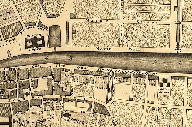
English: Part of the Plan of Greater Dublin including Circular Roads 1797 |
| Date | |
| Source | File:1797-map-of-Dublin.jpg |
| Author | S. J. Neele |
| Other versions |

Licensing
|
This work is in the public domain in its country of origin and other countries and areas where the copyright term is the author's life plus 70 years or fewer. | |
| This file has been identified as being free of known restrictions under copyright law, including all related and neighboring rights. | |
Original upload log
The original description page was here. All following user names refer to de.wikipedia.
| Date/Time | Dimensions | User | Comment |
|---|---|---|---|
| 2016-05-21 05:34 | 1040×687× (197996 bytes) | BirgitSattler | {{Information |Beschreibung = Part of the Plan of Greater Dublin including Circular Roads 1797 |Quelle = https://en.wiki.x.io/wiki/Historical_Maps_of_Dublin#mediaviewer/File:1797-map-of-Dublin.jpg |Urheber = W. Faden, |Datum… |
File history
Click on a date/time to view the file as it appeared at that time.
| Date/Time | Thumbnail | Dimensions | User | Comment | |
|---|---|---|---|---|---|
| current | 12:34, 23 May 2016 | | 1,040 × 687 (193 KB) | Kopiersperre | Transferred from de.wikipedia |
File usage
The following pages on the English Wikipedia use this file (pages on other projects are not listed):
Global file usage
The following other wikis use this file:
- Usage on de.wiki.x.io