Size of this preview: 800 × 543 pixels. Other resolutions: 320 × 217 pixels | 640 × 434 pixels | 1,024 × 695 pixels | 1,280 × 869 pixels | 2,700 × 1,832 pixels.
Original file (2,700 × 1,832 pixels, file size: 2.48 MB, MIME type: image/jpeg)
| This is a file from the Wikimedia Commons. Information from its description page there is shown below. Commons is a freely licensed media file repository. You can help. |
Summary
| Description |
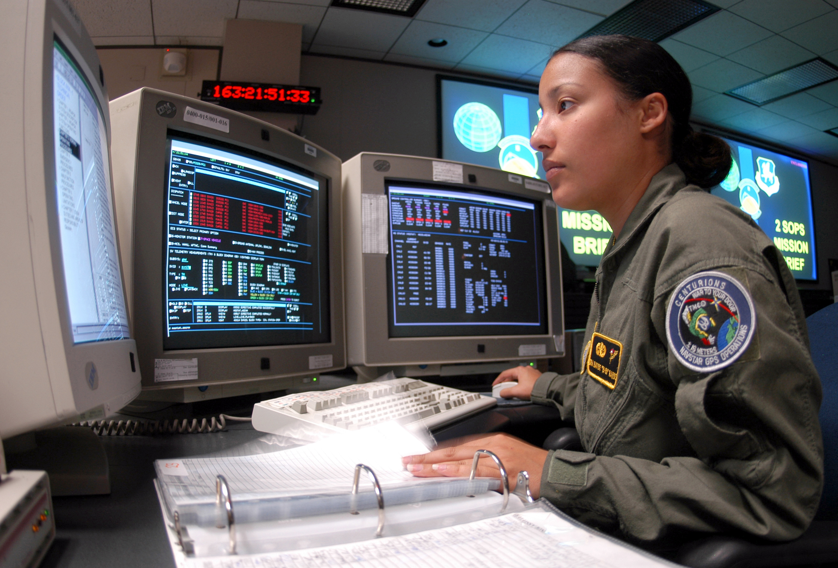
English: Controlling satellites – Senior Airman Nayibe Ramos runs through a checklist during Global Positioning System satellite operations. The operations center here controls a constellation of 29 orbiting satellites that provides navigation data to military and civilian users worldwide. Airman Ramos is a satellite system operator for the 2d Space Operations Squadron at Schriever AFB, Colorado.
Deutsch: Eine US-Luftwaffensoldatin geht in einem Satellitenkontrollraum der Schriever Air Force Base in Colorado (USA) eine Checkliste zur Steuerung von GPS-Satelliten durch. Das Kontrollzentrum der Schriever AFB ist für 29 Satelliten zuständig, die Navigationsdaten für das Militär und zivile Nutzer weltweit liefern. |
|||
| Date | (disputed) | |||
| Source | http://www.af.mil/shared/media/photodb/photos/040205-F-0000C-001.jpg (https://www.af.mil/News/Photos/igphoto/2000594649/) | |||
| Author | United States Air Force photo by Airman 1st Class Mike Meares | |||
| Permission (Reusing this file) |
|

File history
Click on a date/time to view the file as it appeared at that time.
| Date/Time | Thumbnail | Dimensions | User | Comment | |
|---|---|---|---|---|---|
| current | 11:00, 6 February 2006 | | 2,700 × 1,832 (2.48 MB) | Pmsyyz | Controlling satellites Schriever AFB, Colorado -- Senior Airman Nayibe Ramos runs through a checklist during Global Positioning System satellite operations. The operations center here controls a constellation of 29 orbi |
File usage
The following 3 pages use this file:
Global file usage
The following other wikis use this file:
- Usage on ar.wiki.x.io
- Usage on ca.wiki.x.io
- Usage on cs.wiki.x.io
- Usage on da.wiki.x.io
- Usage on de.wiki.x.io
- Usage on es.wiki.x.io
- Usage on fa.wiki.x.io
- Usage on fr.wiki.x.io
- Usage on it.wiki.x.io
- Usage on it.wikiversity.org
- Usage on jv.wiki.x.io
- Usage on ko.wiki.x.io
- Usage on ku.wiki.x.io
- Usage on ml.wiki.x.io
- Usage on oc.wiki.x.io
- Usage on pt.wiki.x.io
- Usage on ro.wiki.x.io
- Usage on si.wiki.x.io
- Usage on vi.wiki.x.io
- Usage on www.wikidata.org
- Usage on zh.wiki.x.io