Size of this preview: 597 × 599 pixels. Other resolutions: 239 × 240 pixels | 478 × 480 pixels | 749 × 752 pixels.
Original file (749 × 752 pixels, file size: 1,019 KB, MIME type: image/png)
File history
Click on a date/time to view the file as it appeared at that time.
| Date/Time | Thumbnail | Dimensions | User | Comment | |
|---|---|---|---|---|---|
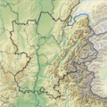
| current | 10:31, 18 December 2012 |  | 749 × 752 (1,019 KB) | Wikisoft* | {{Information |Description ={{fr|1=*Carte Région Rhône-Alpes topographique *fr:Modèle:Géolocalisation/Rhône-Alpes}} |Source =travail personnel sur découpage carte de France topo de User:Sting |Author =~~~~ |Date ... |
File usage
The following 2 pages use this file:
Global file usage
The following other wikis use this file:
- Usage on simple.wiki.x.io
- Usage on si.wiki.x.io
- Usage on uz.wiki.x.io
