
Size of this preview: 800 × 237 pixels. Other resolutions: 320 × 95 pixels | 640 × 190 pixels | 1,024 × 304 pixels | 1,280 × 380 pixels | 2,560 × 759 pixels | 10,736 × 3,184 pixels.
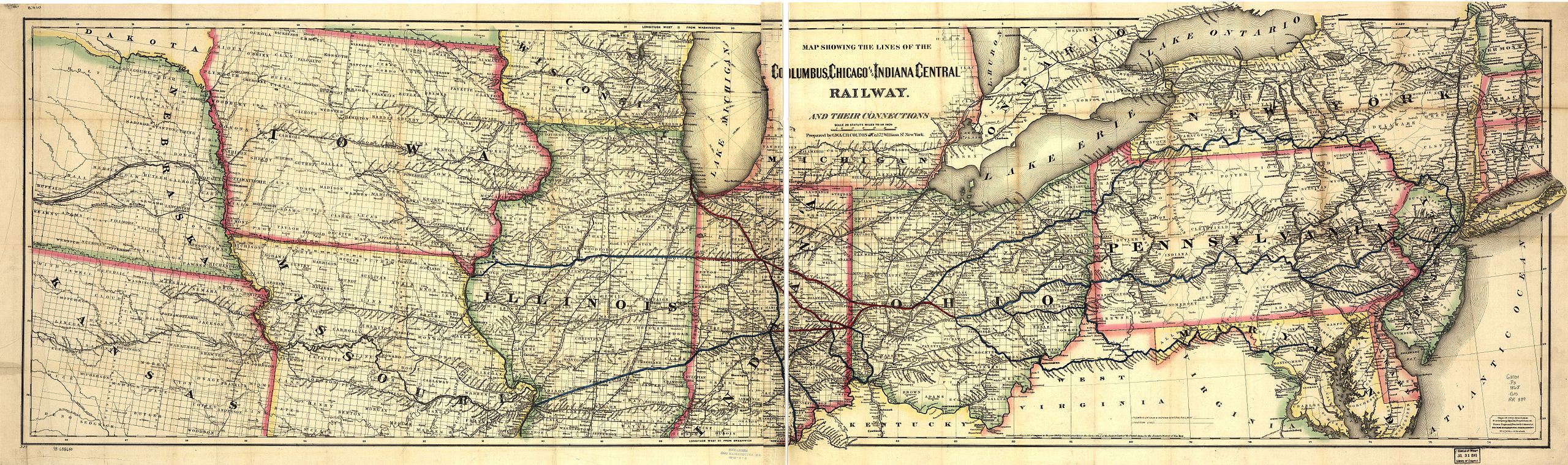
Original file (10,736 × 3,184 pixels, file size: 10.84 MB, MIME type: image/jpeg)
| This is a file from the Wikimedia Commons. Information from its description page there is shown below. Commons is a freely licensed media file repository. You can help. |
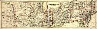
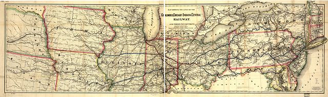
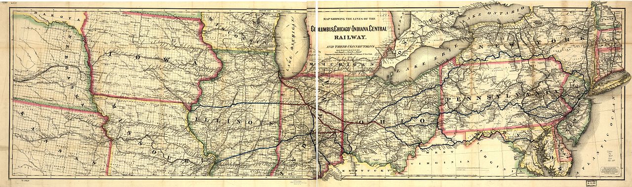
1868 map of the Columbus, Chicago and Indiana Central Railway from Library of Congress.

|
This map is available from the United States Library of Congress's Geography & Map Division
under the digital ID g3701p.rr003890. This tag does not indicate the copyright status of the attached work. A normal copyright tag is still required. See Commons:Licensing.
|
|
This work is in the public domain in its country of origin and other countries and areas where the copyright term is the author's life plus 70 years or fewer. | |
| This file has been identified as being free of known restrictions under copyright law, including all related and neighboring rights. | |
File history
Click on a date/time to view the file as it appeared at that time.
| Date/Time | Thumbnail | Dimensions | User | Comment | |
|---|---|---|---|---|---|
| current | 19:09, 11 September 2005 | 10,736 × 3,184 (10.84 MB) | SPUI~commonswiki | {{PD}} 1868 map of the Columbus, Chicago and Indiana Central Railway from [http://memory.loc.gov/cgi-bin/query/r?ammem/gmd:@field(NUMBER+@band(g3701p+rr003890))]. category:Pittsburgh, Cincinnati, Chicago and St. Louis Railroad [[category:railroad maps |
File usage
The following pages on the English Wikipedia use this file (pages on other projects are not listed):