50°31′45″N 34°54′19″E / 50.52917°N 34.90528°E
Bilka
Білка | |
|---|---|
 | |
| Coordinates: 50°31′45″N 34°54′19″E / 50.52917°N 34.90528°E | |
| Country | |
| Oblast | |
| Raion | Okhtyrka Raion |
| Population | |
| • Total | 1,610 |
| Time zone | UTC+2 (EET) |
| • Summer (DST) | UTC+3 (EEST) |
| Postal Code | 42630 |
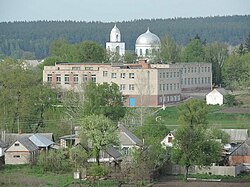
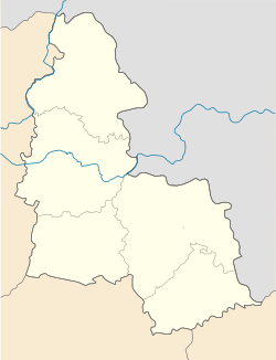
Bilka (Ukrainian: Білка), is a village in northern Ukraine, located in Okhtyrka Raion of Sumy Oblast.
Geography
editThe Boromlya River (a tributary of the Vorskla River) runs through the village. The city of Trostianets is 3 km downstream from the village.
History
editDuring the Holodomor from 1932-1933, more than 300 villagers died from starvation:.[1]
The village was briefly occupied by Russian forces in March 2022[2] during the Russian invasion and subsequent large-scale war. Ukrainians recaptured the village following Russia's retreat from northern and northeastern Ukraine.[3]
Demographics
editIn the 1864 census, the population was 2,933,[4] and by 1897 the population has increased to 3,354.[5]
According to the 2001 Ukrainian Census, the native language distribution is as follows[6]
References
edit- ^ "Геоінформаційна система місць «Голодомор 1932—1933 років в Україні". Ukrainian Institute of National Memory.[permanent dead link]
- ^ Clark, Mason; Barros, George; Kateryna, Stepanenko (2022-03-02). "Russian Offensive Campaign Assessment, March 2". Institute for the Study of War. Retrieved 2022-10-19.
- ^ "Sumy region liberated from Russian troops". Ukrainska Pravda. 2022-04-08. Retrieved 2022-11-12.
- ^ "СПИСОК НАСЕЛЕННЫХ МЕСТ ПО СВЕДЕНИЯМ 1864 ГОДА (1869)". resource.history.org.ua. Retrieved 2022-10-19.
- ^ [Населенные пункты Российской империи численностью 500 и более жителей с указанием общей численности населения в них и числа жителей господствующих вероисповеданий по первой всеобщей переписи населения 1897 года. Санкт-Петербург. 1905. - IX + 270 + 120 стр., (стр. 1-247)]
- ^ "Linguistic Composition of Sumy Oblast, Ukraine (2001 Census)". pop-stat.mashke.org. Retrieved 2022-11-12.

