This article needs additional citations for verification. (December 2013) |
Demra (Bengali: ডেমরা) is a (metropolitan) Thana of Dhaka city, The capital of Bangladesh. It consists of Ward No 64, 65(part),66, 67, 68, 69 and 70 of Dhaka South City Corporation. Demra is Situated in The Eastern Border area of Dhaka City.
Demra Thana
ডেমরা থানা | |
|---|---|
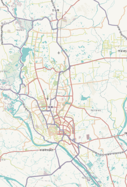
 Expandable map of vicinity of Demra Thana | |
| Coordinates: 23°43.6′N 90°29.7′E / 23.7267°N 90.4950°E | |
| Country | |
| Division | Dhaka Division |
| District | Dhaka District |
| Area | |
• Total | 22.4 km2 (8.6 sq mi) |
| Elevation | 23 m (75 ft) |
| Population | |
• Total | 278,830 |
| • Density | 11,709/km2 (30,330/sq mi) |
| Time zone | UTC+6 (BST) |
| Postal code | 1360[3] |
| Area code | 02[4] |
| Website | bangladesh |
History
editDemra thana was established in 1973. The thana consists of 6 words & 19 mouzas.
Geography
editDemra Thana is located at 23°42′30″N 90°26′30″E / 23.7083°N 90.4417°E. It has 102757 units of household[citation needed] and total area 22.4 km2 [2011].[5]
It is bounded by khilgaon and sabujbagh thanas on the north, Sampur thana and Narayanganj sadar upazila on the south, Rupganj upazila on the east, Kadamtali And jatrabari thanas on the west.
Demographics
editAccording to the 2011 Census of Bangladesh, Demra Thana had 51,645 households with average household size of 4.23 and a population of 226,679. Males constituted 53.73% (121,805) of the population while females 46.27% (104,874). Demra Thana had a literacy rate (age 7 and over) of 73.1%, compared to the national average of 51.8%, and a sex ratio of 116.There were 21 floating people in this jurisdiction. [7]
The religious breakdown was Muslim 97.39% (220,753), Hindu 2.58% (5,838), Christian 0.02% (41), Buddhist 0.01% (34), and others 0.01% (13). The ethnic minority people living there were 87 persons in total.
Parliament's constituency
editDemra is a part of Dhaka-5 parliamentary constituency. It is one of the 300 constituencies of the National Assembly of Bangladesh. It is the 178th seat of the Jatiya Sangsad in the Dhaka district.
The constituency was created for the first general elections in newly independent Bangladesh, held in 1973.
Ahead of the 2008 general election, the Election Commission redrew constituency boundaries to reflect population changes revealed by the 2001 Bangladesh census. 2008 redistricting altered the boundaries of the constituency.
Notable people
edit- Habibur Rahman Mollah (26 January 1942 - 6 May 2020), a Bangladeshi politician, businessman and Member of Parliament.
See also
editReferences
edit- ^ "Geographic coordinates of Dhaka, Bangladesh". DATEANDTIME.INFO. Retrieved 7 July 2016.
- ^ National Report (PDF). Population and Housing Census 2022. Vol. 1. Dhaka: Bangladesh Bureau of Statistics. November 2023. p. 386. ISBN 978-9844752016.
- ^ "Bangladesh Postal Code". Dhaka: Bangladesh Postal Department under the Department of Posts and Telecommunications of the Ministry of Posts, Telecommunications and Information Technology of the People's Republic of Bangladesh. 19 October 2024.
- ^ "Bangladesh Area Code". China: Chahaoba.com. 18 October 2024.
- ^ Rahman, Md. Mohibur (2012). "Demra Thana". In Islam, Sirajul; Jamal, Ahmed A. (eds.). Banglapedia: National Encyclopedia of Bangladesh (Second ed.). Asiatic Society of Bangladesh.
- ^ "Bangladesh Population and Housing Census 2011 Zila Report – Dhaka" (PDF). bbs.gov.bd. Bangladesh Bureau of Statistics.
- ^ "Community Tables: Dhaka district" (PDF). bbs.gov.bd. 2011.


