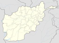
Deh Rawood is a district in Uruzgan Province, southern Afghanistan, and the name of the town that serves as district seat.[1] Deh Rawood lies along the Helmand River. The tribes in the district are Pashtun, dominated by the Noorzai and Populzai sub-tribes.[citation needed]
Deh Rawood
دهراود | |
|---|---|
District | |
| Coordinates: 32°37′35″N 65°28′13″E / 32.62639°N 65.47028°E | |
| Country | |
| Province | Uruzgan Province |
| Seat | Deh Rawood |
The Netherlands, representing the NATO International Security Assistance Force (ISAF) force in Uruzgan Province, has established a military base in Deh Rawod, adjacent to pre-existing U.S. and Afghan Army bases.[citation needed]
Security and Politics
editGovernment includes a district governor, chief of police, court, line departments, and three district shuras:[2]
- A 29-person development shura composed of tribal elders and engineers who monitor the implementation of development projects.
- A 40-person tribal shura.
- A 73-person malikan (village representative) shura that serves as a contact point for international actors.
On 19 November 2009 it was reported that a suicide bomber blew himself up in Deh Rawad district in a crowded area. The attack killed 10 and injured 13.[3]
On 17 December 2009, another suicide bomber blew himself up but failed at his attempt to get inside of the district headquarters.[4]
On 16 December 2020, the Taliban launched a surprise attack on the district, killing 20 ANDSF members including the district's deputy police chief of the district. The Taliban occupied the bazaar of the district before being pushed out by remaining militia forces in the area.[5]
On 29 December 2020, a Taliban flag was reported to have been flown over the city's center, indicating that Afghan forces have left the area.[6]
See also
editReferences
edit- ^ "District Names". National Democratic Institute. Archived from the original on 29 January 2016. Retrieved 2 June 2015.
- ^ "A socio-political assessment of Uruzgan Province from 2006 to 2009" (PDF). The Liaison Office. Archived from the original (PDF) on 3 June 2015. Retrieved 2 June 2015.
- ^ "Suicide bomber kills 10 Afghan civilians, wound 13 others ." Xinhua News Agency. Kabul. 19 November 2009. Accessed at: [1]
- ^ "Suicide bombing wounds 4 soldiers in S Afghanistan." Xinhua News Agency. 17 December 2009. Accessed at: http://english.people.com.cn/90001/90777/90851/6845604.html
- ^ "At least 20 members of ANDSF including several important district level commanders were killed in a Taliban attack against Dehrawooad district, Uruzgan. Taliban launched attack last night and dead bodies of ANDSF put on the road by Taliban, multiple sources in Uruzgan tells Tarin Kawt,Oruzgan". Afghanistan news map - security alerts from Afghanistan - afghanistan.liveuamap.com. Retrieved 16 December 2020.
- ^ "Taliban flag spotted at the main roundabout in Dehrawud market area in Uruzgan. Looks like the area is fully under Taliban control Tarin Kawt,Oruzgan - Map of Central Asia: Kazakhstan, Kyrgyzstan, Tajikistan, Turkmenistan, Uzbekistan - centralasia.liveuamap.com". Map of Central Asia: Kazakhstan, Kyrgyzstan, Tajikistan, Turkmenistan, Uzbekistan - centralasia.liveuamap.com. Retrieved 29 December 2020.
32°37′35″N 65°28′13″E / 32.62639°N 65.47028°E
