The Parliamentary Complex of Indonesia (Indonesian: Kompleks Parlemen Republik Indonesia),[1][2] also known as the MPR/DPR/DPD Building, is the seat of government for the Indonesian legislative branch of government, which consists of the People's Consultative Assembly (MPR), the House of Representatives (DPR) and the Regional Representative Council (DPD).
| Parliamentary Complex of Indonesia | |
|---|---|
Kompleks Parlemen Republik Indonesia | |
 The main building, Nusantara | |
| General information | |
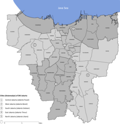
| Location | Central Jakarta, Jakarta, Indonesia |
| Coordinates | 6°12′37″S 106°48′00″E / 6.21028°S 106.80000°E |
| Construction started | 8 March 1965 |
| Completed | February 1983 (Main building completed in 1968) |
| Height | 100 metres |
| Technical details | |
| Size | 80,000 m2 |
| Design and construction | |
| Architect(s) | Soejoedi Wirjoatmodjo |
History
editConstruction
editSukarno administration
editConstruction of the building was ordered on March 8, 1965 by Sukarno, the first president of Indonesia, through the Presidential Decree of the Republic of Indonesia Number 48 of 1965. The building was intended to house the Conference of New Emerging Forces (CONEFO), a now defunct alternative for the United Nations, with the first conference being scheduled to be held in 1966. The members of the organization were planned to consist of the countries of Asia, Africa, Latin America, and the Non-Aligned Movement.
The first conference was scheduled to be held in 1966, and the building was scheduled for completion before August 17, 1966 — leaving 17 months left for the construction to take place. Construction began in March 1965 following a contest for the design, which resulted in the design by architect Soejoedi Wirjoatmodjo being agreed upon and ratified by President Sukarno on February 22, 1965.
Suharto administration
editConstruction was hampered due to the coup attempt on September 30, 1965. The CONEFO idea was soon abandoned after Sukarno's fall, but the building's construction was resumed based on the Decree of the Presidium of the Ampera Cabinet Number 79/U/Kep/11/1966 dated November 9, 1966, whose designation was changed for the MPR/DPR RI Building.
Gradually, construction was completed and handed over to the Secretariat General of the DPR: Main Conference Building (March 1968), Secretariat Building and Health Center Building (March 1978), Auditorium Building (September 1982), and Banquet Building (February 1983).[3][4]
May 1998
editIn May 1998, the buildings were occupied by about 80,000 tertiary students[5] protesting against the Trisakti shootings and the continuation of Suharto's New Order regime, which also calling for the dissolution of the People's Representative Council and People's Consultative Assembly of the 1998–2003 period.[6]
Buildings
editThe complex comprises six buildings. The main building is Nusantara with its unique Garuda wing-shaped roof[3] and contains the 1,700-seat plenary meeting hall. The other five buildings are Nusantara I, a 23-storey building containing parliament members' offices and meeting rooms; Nusantara II and Nusantara III, which contain committee meeting rooms and offices; Nusantara IV, used for conferences and ceremonies; and Nusantara V, which has a 500-seat plenary hall.
Gallery
edit-
A People's Consultative Assembly session in 1999 inside Nusantara
-
People's Representative Council meeting hall inside Nusantara II
-
Detail of the national emblem displayed in front of Nusantara's meeting hall
-
Featured on the reverse side of the 2014 issued 100,000 rupiah note
-
Featured in a 1993 stamp
-
Featured in a 1993 stamp
Presidential inauguration
edit-
Megawati after Wahid's impeachment and her inauguration, 2001
References
editCitations
edit- ^ BSID-MPR. "MPR RI | Rumah Kebangsaan". mpr.go.id. Retrieved 2021-10-14.
- ^ "Kontak". www.dpr.go.id. Retrieved 2021-10-14.
- ^ a b Merrillees 2015, p. 123.
- ^ "Riwayat Nama Ruang dan Gedung Parlemen". Historia - Majalah Sejarah Populer Pertama di Indonesia (in Indonesian). 2014-11-27. Retrieved 2021-10-14.
- ^ 80.000 students occupied the DPR/MPR Building Archived 2008-09-25 at the Wayback Machine pg. 5
- ^ "Semanggi Peduli". Archived from the original on 2017-01-14. Retrieved 2009-01-27.
Bibliography
edit- MPR/DPR-RI Buildings at a Glance. Secretariat General of DPR-RI. 2001.
- Merrillees, Scott (2015). Jakarta: Portraits of a Capital 1950-1980. Jakarta: Equinox Publishing. ISBN 9786028397308.
External links
edit- History of the DPR/MPR Building (in Indonesian)
- Occupation of the DPR/MPR Building (in Indonesian)
- Ex-Reform activist: No manipulation in the DPR/MPR building occupation (in Indonesian)
