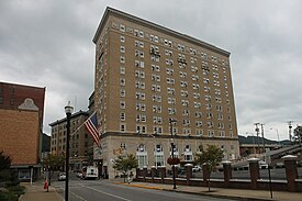
Bluefield micropolitan area
The Bluefield Micropolitan Statistical Area, as defined by the United States Census Bureau, is an area consisting of two counties – one in West Virginia and one in Virginia – anchored by the town of Bluefield, West Virginia.
Bluefield, WV–VA
Bluefield, WV–VA Micropolitan Statistical Area | |
|---|---|
 | |
 | |
| Country | |
| State | |
| Largest city | Bluefield, WV |
| Other municipalities | Princeton, WV Bluefield, VA |
| Time zone | UTC−5 (EST) |
| • Summer (DST) | UTC−4 (EDT) |
As of the 2010 census, the μSA had a population of 107,342.[1]
Counties
editCommunities
edit- Places with 5,000 to 10,000 inhabitants
- Places with 1,000 to 5,000 inhabitants
- Places with less than 1,000 inhabitants
- Unincorporated places
Demographics
editAs of the census[2] of 2010, there were 107,342 people, 44,052 households, and 30,053 families residing within the μSA. The racial makeup of the μSA was 94.2% White, 5.5% African American, 0.6% Native American, 0.7% Asian, 0.0% Pacific Islander, 0.3% from other races, and 0.1% from two or more races. Hispanic or Latino of any race were 0.7% of the population.
In 2000 the median income for a household in the μSA was $31,841, and the median income for a family was $40,315. The per capita income for the μSA was $17,638.[3]
See also
editReferences
edit- ^ "Profile of General Population and Housing Characteristics: 2010". United States Census Bureau, Population Division. Retrieved 2011-03-05.
- ^ "U.S. Census website". United States Census Bureau. Retrieved 2008-01-31.
- ^ SELECTED ECONOMIC CHARACTERISTICS | http://factfinder.census.gov/bkmk/table/1.0/en/ACS/10_1YR/CP03/310M100US14140 Archived 2020-02-12 at archive.today | publisher = United States Census Bureau, Population Division | accessdate = 2011-03-05