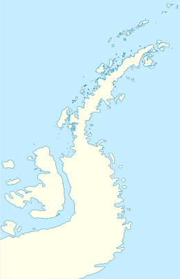
Ardley Island is an island 1.9 kilometres (1 nmi) long, lying in Maxwell Bay close off the south-west end of King George Island, in the South Shetland Islands of Antarctica. It was charted as a peninsula in 1935 by Discovery Investigations personnel of the Discovery II and named for Lieutenant R.A.B. Ardley, Royal Naval Reserve, an officer on the ship in 1929–31 and 1931–33. Aerial photography has since shown that the feature is an island with Braillard Point being the headland forming the northeast end of Ardley Island.[3] It has been designated an Antarctic Specially Protected Area (ASPA 150) because of the importance of its seabird colonies.
| Geography | |
|---|---|
| Location | Antarctica |
| Coordinates | 62°12′47″S 58°55′59″W / 62.21308°S 58.93317°W |
| Administration | |
| Administered under the Antarctic Treaty System | |
| Demographics | |
| Population | Data not available |
| Ardley Island Light | |
| Foundation | concrete base |
| Construction | fiber glass tower |
| Height | 6 metres (20 ft)[1] |
| Shape | conical truncated tower[2] |
| Markings | orange and black horizontal band |
| Power source | solar power |
| Focal height | 45 metres (148 ft)[1] |
| Range | 6 nautical miles (11 km; 6.9 mi)[1] |
| Characteristic | Fl W 10s.[1] |

Birds
editThe island has been identified as an Important Bird Area by BirdLife International because it supports a breeding colony of about 4,600 pairs of gentoo penguins, as well as smaller numbers of Adélie and chinstrap penguins, southern giant petrels, Wilson's and black-bellied storm petrels, Cape petrels, brown and south polar skuas, and Antarctic terns.[4]
A 2016 study examined lake guano sediments and studied penguin population dynamics over 7,000 years. Three of five population growth phases were terminated by a sudden crash, due to volcanic eruptions from the active volcano of Deception Island, 120 km to the southwest.[5][6]
Research Stations
editBallvé
editThere are also two Argentinean buildings in the area that make up the Ballvé Refuge, set up in 1953, approximately 50 meters east of Ripamonti I. An Argentinean radio beacon facilitates navigation, looking towards Maxwell Bay (Fildes Bay). All the structures described remain in the area year-round. The scientists come from King George Island for their expeditions. [1]
Ripamonti I
editThere are two Chilean semi-permanent summer-only research shelters. Ripamonti I (62°12’ S; 58°53’ W) was established in 1982.
Ripamonti II
editIn the northern coast of Ardley, and Ripamonti II (former Alfred Wegener Institute hut, ceded to Chile by Germany in 1997) lies almost 100 metres southwest from Braillard Point on the south-eastern part, inside the penguin breeding colonies.
See also
editReferences
edit- ^ a b c d List of Lights, Pub. 111: The West Coasts of North and South America (Excluding Continental U.S.A. and Hawaii), Australia, Tasmania, New Zealand, and the Islands of the North and South Pacific Oceans (PDF). List of Lights. United States National Geospatial-Intelligence Agency. 2017.
- ^ Rowlett, Russ. "Lighthouses of Antarctica". The Lighthouse Directory. University of North Carolina at Chapel Hill. Retrieved 15 May 2017.
- ^ "Ardley Island". Geographic Names Information System. United States Geological Survey, United States Department of the Interior. Retrieved 12 May 2011.
- ^ "Ardley Island, King George Island". BirdLife data zone: Important Bird Areas. BirdLife International. 2012. Archived from the original on 10 July 2007. Retrieved 8 December 2012.
- ^ Jonathan Amos (11 April 2017). "Poo sediments record Antarctic 'penguin Pompeii'". BBC News Online.
- ^ Stephen J. Roberts; Patrick Monien; Louise C. Foster; Julia Loftfield; Emma P. Hocking; Bernhard Schnetger; Emma J. Pearson; Steve Juggins; Peter Fretwell; Louise Ireland; Ryszard Ochyra; Anna R. Haworth; Claire S. Allen; Steven G. Moreton; Sarah J. Davies; Hans-Jürgen Brumsack; Michael J. Bentley & Dominic A. Hodgson (2017). "Past penguin colony responses to explosive volcanism on the Antarctic Peninsula". Nature Communications. 8 (14914): 14914. Bibcode:2017NatCo...814914R. doi:10.1038/ncomms14914. PMC 5394244. PMID 28398353.
This article incorporates public domain material from "Ardley Island". Geographic Names Information System. United States Geological Survey.

