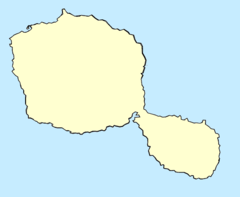
Afaʻahiti is a village and associated commune in Tahiti. It is located on Tahiti Iti (little Tahiti) close to the Taravao isthmus, which connects Tahiti Nui (big Tahiti) to Tahiti Iti. The area is rural with many small villages. The official languages are French and Tahitian. The currency is the Pacific franc (XPF). Population as of 2022 was 6,829.[1] Tahiti's west coast freeway runs nearby the commune. The Faaa International Airport is another way to transport in Afaʻahiti.
Afaʻahiti | |
|---|---|
Location within Tahiti | |
| Coordinates: 17°44′10″S 149°18′30″W / 17.73611°S 149.30833°W | |
| Country | France |
| Overseas collectivity | French Polynesia |
| Commune | Taiarapu-Est |
| Population (2022)[1] | 6,829 |
| Time zone | UTC−10:00 |
Geography
editClimate
editAfaʻahiti has a tropical rainforest climate (Köppen climate classification Af). The average annual temperature in Afaʻahiti is 23.2 °C (73.8 °F). The average annual rainfall is 3,374.7 mm (132.86 in) with January as the wettest month. The temperatures are highest on average in March, at around 24.5 °C (76.1 °F), and lowest in August, at around 21.8 °C (71.2 °F). The highest temperature ever recorded in Afaʻahiti was 34.2 °C (93.6 °F) on 7 March 1979; the coldest temperature ever recorded was 12.0 °C (53.6 °F) on 2 July 1984.
| Climate data for Afaʻahiti (1991–2020 normals, extremes 1968−present) | |||||||||||||
|---|---|---|---|---|---|---|---|---|---|---|---|---|---|
| Month | Jan | Feb | Mar | Apr | May | Jun | Jul | Aug | Sep | Oct | Nov | Dec | Year |
| Record high °C (°F) | 32.5 (90.5) |
32.5 (90.5) |
34.2 (93.6) |
32.0 (89.6) |
32.0 (89.6) |
31.0 (87.8) |
30.3 (86.5) |
29.8 (85.6) |
31.0 (87.8) |
30.7 (87.3) |
32.0 (89.6) |
31.0 (87.8) |
34.2 (93.6) |
| Mean daily maximum °C (°F) | 27.3 (81.1) |
27.6 (81.7) |
27.9 (82.2) |
27.6 (81.7) |
26.8 (80.2) |
25.9 (78.6) |
25.5 (77.9) |
25.3 (77.5) |
25.4 (77.7) |
26.0 (78.8) |
26.6 (79.9) |
26.8 (80.2) |
26.6 (79.9) |
| Daily mean °C (°F) | 24.1 (75.4) |
24.3 (75.7) |
24.5 (76.1) |
24.2 (75.6) |
23.4 (74.1) |
22.5 (72.5) |
22.0 (71.6) |
21.8 (71.2) |
22.1 (71.8) |
22.5 (72.5) |
23.3 (73.9) |
23.7 (74.7) |
23.2 (73.8) |
| Mean daily minimum °C (°F) | 20.8 (69.4) |
21.0 (69.8) |
21.1 (70.0) |
20.9 (69.6) |
20.0 (68.0) |
19.1 (66.4) |
18.5 (65.3) |
18.2 (64.8) |
18.7 (65.7) |
19.1 (66.4) |
20.0 (68.0) |
20.6 (69.1) |
19.8 (67.6) |
| Record low °C (°F) | 16.2 (61.2) |
16.5 (61.7) |
15.5 (59.9) |
15.5 (59.9) |
14.9 (58.8) |
12.0 (53.6) |
12.0 (53.6) |
13.0 (55.4) |
12.3 (54.1) |
13.4 (56.1) |
14.0 (57.2) |
15.0 (59.0) |
12.0 (53.6) |
| Average precipitation mm (inches) | 468.8 (18.46) |
374.8 (14.76) |
339.6 (13.37) |
297.7 (11.72) |
235.0 (9.25) |
186.4 (7.34) |
154.5 (6.08) |
139.0 (5.47) |
178.4 (7.02) |
247.5 (9.74) |
288.8 (11.37) |
464.2 (18.28) |
3,374.7 (132.86) |
| Average precipitation days (≥ 1 mm) | 23.5 | 21.6 | 21.3 | 18.7 | 16.7 | 15.7 | 15.7 | 13.7 | 16.6 | 17.7 | 18.9 | 23.8 | 223.9 |
| Source: Météo-France[2] | |||||||||||||
References
edit- ^ a b "Les résultats du recensement de la population 2022 de Polynésie française" [Results of the 2022 population census of French Polynesia] (PDF) (in French). Institut de la statistique de la Polynésie française. January 2023.
- ^ "Afaahiti 2 (987)" (PDF). Météo-France. Retrieved January 16, 2023.

